Temirlanovka night lights from space
Night Light of Temirlanovka (South Kazakhstan) from space (Kazakhstan) Src. Average luminocity for 10x10km area is 2.1197% and for 50x50km: 0.5095%.
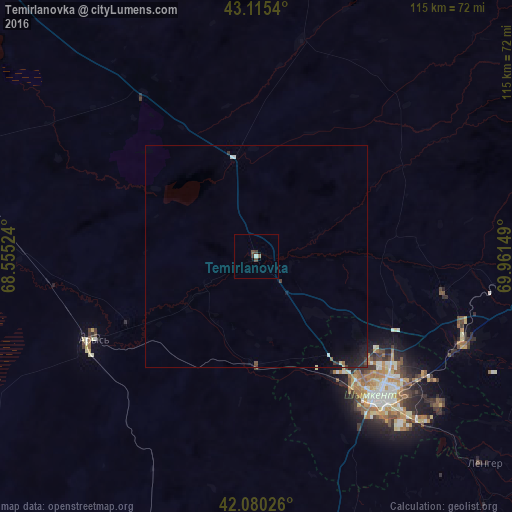
Analysis of Temirlanovka night lights 2016
Square area 10x10 km:
 0.45%
0.45%90-99
0.15%80-89
0%70-79
0%60-69
0.3%50-59
0.3%40-49
1.21%30-39
0.91%20-29
0.3%10-19
0%0-9
96.36%Square area 50x50 km:
0.05%90-99
0.05%80-89
0.05%70-79
0%60-69
0.04%50-59
0.04%40-49
0.12%30-39
0.15%20-29
0.18%10-19
0.59%0-9
98.74%Clear (daylight) street map image can be seen on geolist.org.
Map coordinates:
43° 6' 55.4" North, 68° 33' 18.9" East
42° 35' 59.9" North, 69° 15' 30.1" East
42° 4' 48.9" North, 69° 57' 41.4" East
Some cities around Temirlanovka sort by population:
• Shymkent
43.6 km =27.1 mi,  139°
139°
• Arys
41.4 km =25.7 mi,  242°
242°
• Belyye Vody
50.6 km =31.4 mi,  113°
113°
• Lenger
69.4 km =43.1 mi,  132°
132°
• Turar Ryskulov
89.7 km =55.7 mi,  94°
94°
• Tyul’kubas
85.9 km =53.4 mi,  98°
98°
• Chayan
49.3 km =30.6 mi,  11°
11°
• Sastobe
60.8 km =37.8 mi, 94°
1518266 (p: 12,245)
Sources (retrieved 2019-11-25):
» Earth at Night: Flat Maps 2012, 2016