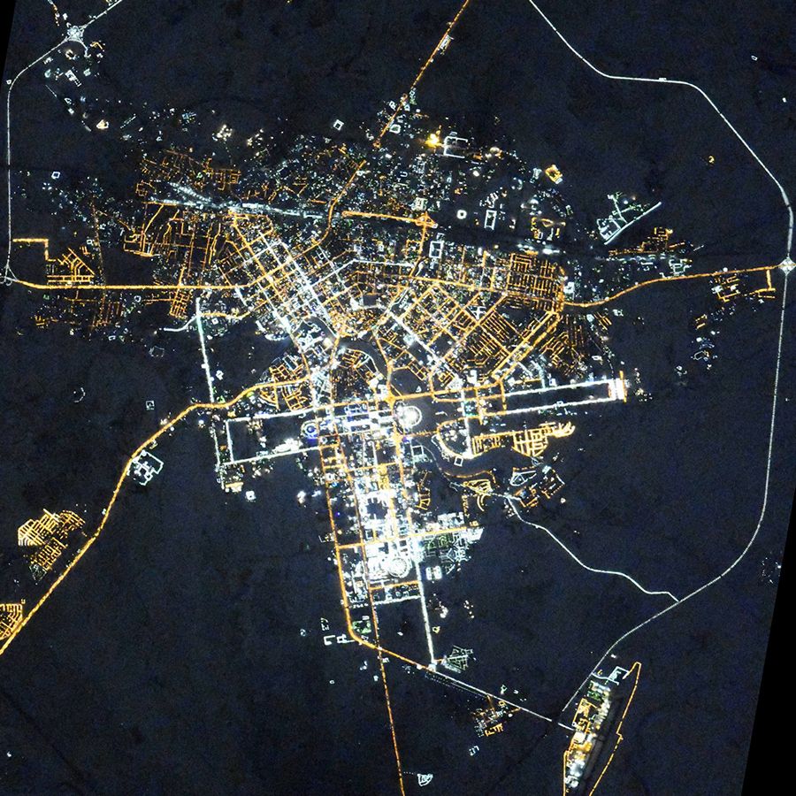
Nur-Sultan night lights from space
Night Light of Nur-Sultan from space (Kazakhstan) Src. Average luminocity for 10x10km area is 90.6136% and for 50x50km: 12.0198%.

Analysis of Nur-Sultan night lights 2016
Square area 10x10 km:
 63.5%
63.5%90-99
17.38%80-89
1.2%70-79
4.95%60-69
2.27%50-59
2.27%40-49
1.2%30-39
5.48%20-29
1.74%10-19
0%0-9
0%Square area 50x50 km:
4.19%90-99
2.34%80-89
0.58%70-79
1.11%60-69
1.1%50-59
1.22%40-49
1.08%30-39
1.51%20-29
3.22%10-19
4.64%0-9
79.02%Clear (daylight) street map image can be seen on geolist.org.
Map coordinates:
51° 37' 7.6" North, 70° 44' 34.3" East
51° 10' 48.4" North, 71° 26' 45.5" East
50° 44' 14" North, 72° 8' 56.8" East
Fantastic image of Nur-Sultan from space taken by astronauts [src2], but I don't have information about it's orientation, scale or angle. If necessary, it was rotated manually, so North points approximately to upper direction. Click to zoom in:
Some cities around Nur-Sultan sort by population:
• Stepnogorsk
133.6 km =83 mi,  12°
12°
• Yermentau
125 km =77.7 mi,  66°
66°
• Aksu
144.9 km =90 mi, 14°
• Osakarovka
104.6 km =65 mi,  131°
131°
• KÄ«evka
102.3 km =63.6 mi,  175°
175°
• Shortandy
65.7 km =40.8 mi,  331°
331°
• Zholymbet
65.2 km =40.5 mi,  16°
16°
• Astrakhan
121 km =75.2 mi,  288°
288°
1526273 (p: 345,604)
Sources (retrieved 2019-11-25):
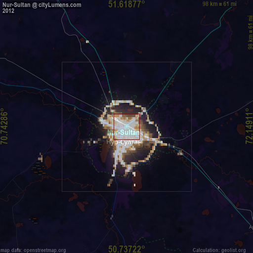
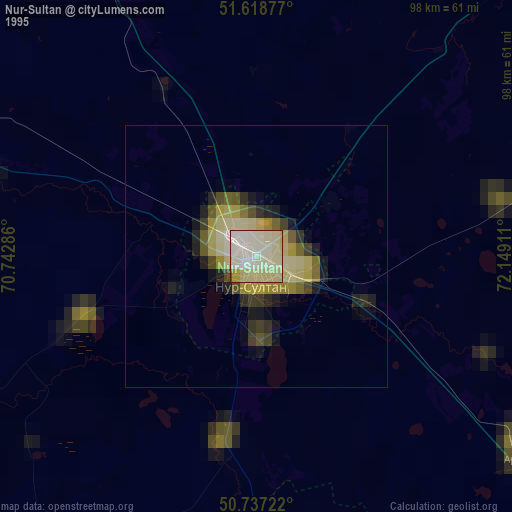
» NASA, Earths city lights 1995
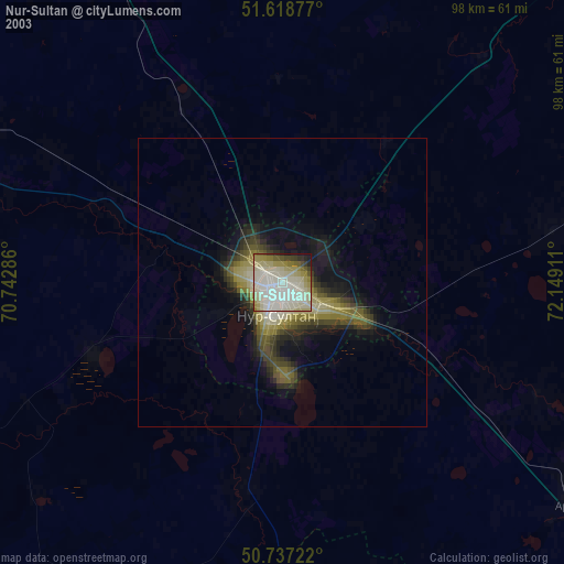
» NASA city lights 2003
» Earth at Night: Flat Maps 2012, 2016
Src.2: picture by Oleg Kononenko, Roscosmos, retrieved 2019-11-29