Atakent night lights from space
Night Light of Atakent (South Kazakhstan) from space (Kazakhstan) Src. Average luminocity for 10x10km area is 3.398% and for 50x50km: 3.6944%.
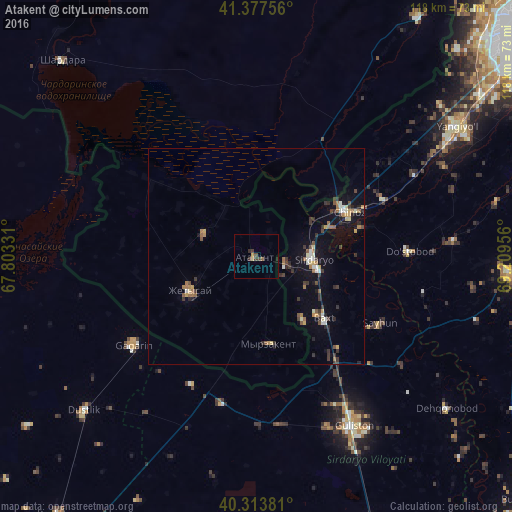
Analysis of Atakent night lights 2016
Square area 10x10 km:
 0%
0%90-99
0%80-89
0%70-79
0.51%60-69
0.85%50-59
0.68%40-49
1.02%30-39
2.72%20-29
0.68%10-19
0%0-9
93.54%Square area 50x50 km:
0.21%90-99
0.45%80-89
0.32%70-79
0.4%60-69
0.66%50-59
0.49%40-49
0.47%30-39
1.03%20-29
0.72%10-19
2.27%0-9
92.97%Clear (daylight) street map image can be seen on geolist.org.
Map coordinates:
41° 22' 39.2" North, 67° 48' 11.9" East
40° 50' 52.2" North, 68° 30' 23.1" East
40° 18' 49.7" North, 69° 12' 34.4" East
Some cities around Atakent sort by population:
• Guliston, UZ
46.2 km =28.7 mi,  149°
149°
• Sirdaryo, UZ
13.1 km =8.1 mi,  92°
92°
• Gagarin, UZ
34.9 km =21.7 mi,  233°
233°
• Zafar, UZ
36.3 km =22.6 mi,  65°
65°
• Chinoz, UZ
23.6 km =14.7 mi, 65°
• Asyqata
13 km =8.1 mi,  293°
293°
• Myrzakent
20.8 km =12.9 mi,  170°
170°
• Amir Timur, UZ
41.2 km =25.6 mi,  62°
62°
1524138 (p: 12,895)
Sources (retrieved 2019-11-25):
» Earth at Night: Flat Maps 2012, 2016