Asyqata night lights from space
Night Light of Asyqata (South Kazakhstan) from space (Kazakhstan) Src. Average luminocity for 10x10km area is 2.5867% and for 50x50km: 1.4967%.
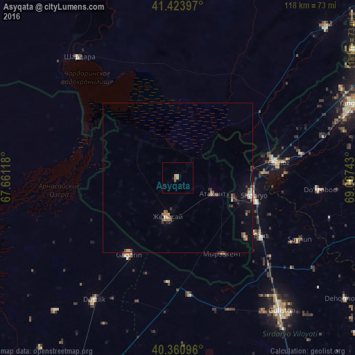
Analysis of Asyqata night lights 2016
Square area 10x10 km:
 0%
0%90-99
0%80-89
0%70-79
0.68%60-69
1.36%50-59
0.68%40-49
0.68%30-39
0%20-29
0%10-19
0.68%0-9
95.92%Square area 50x50 km:
0.04%90-99
0.18%80-89
0.08%70-79
0.16%60-69
0.37%50-59
0.26%40-49
0.2%30-39
0.47%20-29
0.16%10-19
0.68%0-9
97.4%Clear (daylight) street map image can be seen on geolist.org.
Map coordinates:
41° 25' 26.3" North, 67° 39' 40.2" East
40° 53' 40.6" North, 68° 21' 51.5" East
40° 21' 39.5" North, 69° 4' 2.7" East
Some cities around Asyqata sort by population:
• Sirdaryo, UZ
25.6 km =15.9 mi,  102°
102°
• Gagarin, UZ
30.5 km =19 mi,  212°
212°
• Zafar, UZ
46.1 km =28.6 mi,  77°
77°
• Chinoz, UZ
33.7 km =20.9 mi, 82°
• Dŭstlik, UZ
49.6 km =30.8 mi, 213°
• Atakent
13 km =8.1 mi,  113°
113°
• Myrzakent
29.9 km =18.6 mi,  149°
149°
• Amir Timur, UZ
50.4 km =31.3 mi,  74°
74°
1522643 (p: 11,378)
Sources (retrieved 2019-11-25):
» Earth at Night: Flat Maps 2012, 2016