Kokshetau night lights from space
Night Light of Kokshetau (Aqmola) from space (Kazakhstan) Src. Average luminocity for 10x10km area is 39.101% and for 50x50km: 2.3068%.
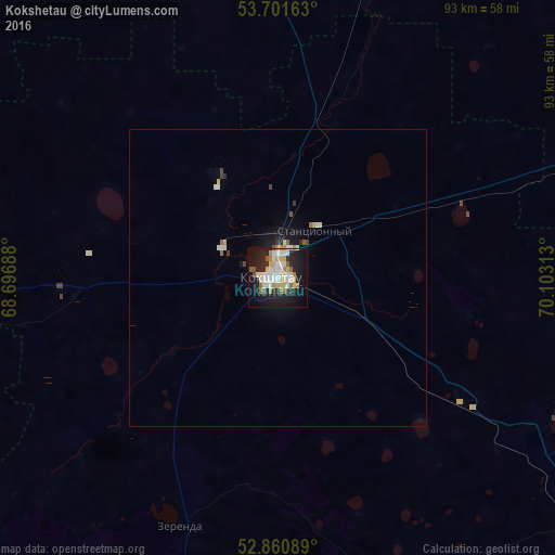
Analysis of Kokshetau night lights 2016
Square area 10x10 km:
 7.45%
7.45%90-99
9.22%80-89
6.19%70-79
3.79%60-69
4.67%50-59
4.04%40-49
1.52%30-39
1.01%20-29
11.99%10-19
32.2%0-9
17.93%Square area 50x50 km:
0.34%90-99
0.52%80-89
0.3%70-79
0.19%60-69
0.26%50-59
0.25%40-49
0.12%30-39
0.15%20-29
0.57%10-19
2.01%0-9
95.28%Clear (daylight) street map image can be seen on geolist.org.
Map coordinates:
53° 42' 5.9" North, 68° 41' 48.8" East
53° 16' 60" North, 69° 24' 0" East
52° 51' 39.2" North, 70° 6' 11.3" East
Some cities around Kokshetau sort by population:
• Shchuchinsk
65.3 km =40.6 mi,  126°
126°
• Makinsk
99.4 km =61.8 mi,  136°
136°
• Akkol’
13.4 km =8.3 mi,  83°
83°
• Taiynsha
67.3 km =41.8 mi,  21°
21°
• Būrabay
64.8 km =40.3 mi,  110°
110°
• Balkashino
95.6 km =59.4 mi,  207°
207°
• Smirnovo
136.9 km =85.1 mi,  0°
0°
• Shantobe
123.6 km =76.8 mi,  221°
221°
1522203 (p: 124,444)
Sources (retrieved 2019-11-25):
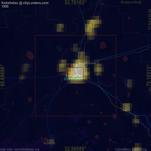
» NASA, Earths city lights 1995
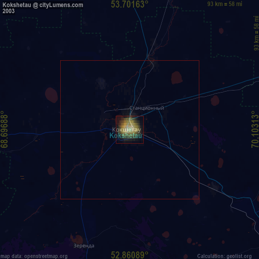
» NASA city lights 2003
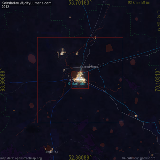
» Earth at Night: Flat Maps 2012, 2016