Ungsang night lights from space
Night Light of Ungsang (Gyeongsangnam-do) from space (South Korea) Src. Average luminocity for 10x10km area is 47.0018% and for 50x50km: 44.5127%.
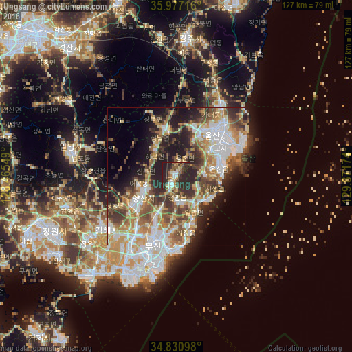
Analysis of Ungsang night lights 2016
Square area 10x10 km:
 5.49%
5.49%90-99
8.24%80-89
4.58%70-79
4.03%60-69
9.52%50-59
7.33%40-49
4.95%30-39
13.37%20-29
37.55%10-19
4.95%0-9
0%Square area 50x50 km:
8.52%90-99
9.07%80-89
5.58%70-79
6.24%60-69
7.09%50-59
6.57%40-49
6.33%30-39
7.36%20-29
10.05%10-19
10.49%0-9
22.71%Clear (daylight) street map image can be seen on geolist.org.
Map coordinates:
35° 58' 37.8" North, 128° 27' 55.8" East
35° 24' 22" North, 129° 10' 7" East
34° 49' 51.5" North, 129° 52' 18.3" East
Some cities around Ungsang sort by population:
• Busan
36.1 km =22.4 mi,  200°
200°
• Ulsan
19.8 km =12.3 mi,  42°
42°
• Changwon
48.5 km =30.1 mi,  245°
245°
• Kimhae
32.3 km =20.1 mi,  233°
233°
• Gyeongju
48.7 km =30.3 mi,  4°
4°
• Yangsan
14.2 km =8.8 mi,  239°
239°
• Miryang
39.2 km =24.4 mi,  284°
284°
• Gijang
18.5 km =11.5 mi,  167°
167°
1912205 (p: 83,360)
Sources (retrieved 2019-11-25):
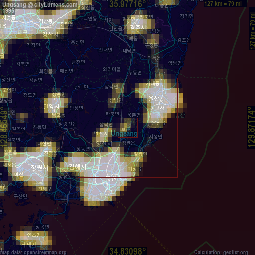
» NASA, Earths city lights 1995
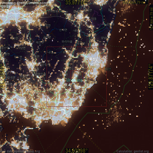
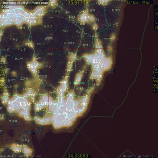
» NASA city lights 2003
» Earth at Night: Flat Maps 2012, 2016