Gijang night lights from space
Night Light of Gijang (Busan) from space (South Korea) Src. Average luminocity for 10x10km area is 60.3112% and for 50x50km: 38.6224%.
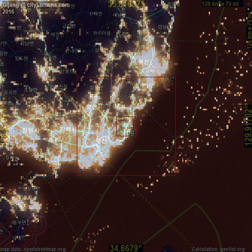
Analysis of Gijang night lights 2016
Square area 10x10 km:
 6.82%
6.82%90-99
11.01%80-89
8.22%70-79
11.71%60-69
10.66%50-59
19.93%40-49
9.09%30-39
5.77%20-29
11.54%10-19
5.24%0-9
0%Square area 50x50 km:
8.73%90-99
8.87%80-89
4.53%70-79
5.14%60-69
5.14%50-59
5.25%40-49
4.92%30-39
5.18%20-29
8.14%10-19
7.57%0-9
36.54%Clear (daylight) street map image can be seen on geolist.org.
Map coordinates:
35° 48' 58.9" North, 128° 30' 38.8" East
35° 14' 39" North, 129° 12' 50" East
34° 40' 4.4" North, 129° 55' 1.3" East
Some cities around Gijang sort by population:
• Busan
23 km =14.3 mi,  226°
226°
• Ulsan
33.9 km =21.1 mi,  15°
15°
• Changwon
48.4 km =30.1 mi,  267°
267°
• Kimhae
30.2 km =18.8 mi, 267°
• Ungsang
18.5 km =11.5 mi,  347°
347°
• Naesŏ
63 km =39.1 mi, 270°
• Yangsan
19.6 km =12.2 mi,  303°
303°
• Miryang
50.4 km =31.3 mi, 303°
1842966 (p: 43,064)
Sources (retrieved 2019-11-25):
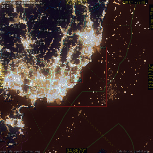
» Earth at Night: Flat Maps 2012, 2016