Busan night lights from space
Night Light of Busan from space (South Korea) Src. Average luminocity for 10x10km area is 92.4091% and for 50x50km: 40.5607%.
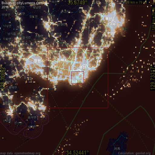
Analysis of Busan night lights 2016
Square area 10x10 km:
 43.88%
90-99
30.24%80-89
10.49%70-79
8.04%60-69
2.27%50-59
3.67%40-49
1.4%30-39
0%20-29
0%10-19
0%0-9
0%Square area 50x50 km:
9.1%90-99
9.92%80-89
5.25%70-79
7.69%60-69
5.69%50-59
5.29%40-49
4.05%30-39
3.83%20-29
3.99%10-19
4.92%0-9
40.26%Clear (daylight) street map image can be seen on geolist.org.
Map coordinates:
35° 40' 29.6" North, 128° 19' 36.9" East
35° 6' 6" North, 129° 1' 48.1" East
34° 31' 27.9" North, 129° 43' 59.4" East
Some cities around Busan sort by population:
• Changwon
34.7 km =21.6 mi,  293°
293°
• Kimhae
20 km =12.4 mi,  317°
317°
• Ungsang
36.1 km =22.4 mi,  20°
20°
• Sinhyeon
44.1 km =27.4 mi,  236°
236°
• Naesŏ
49.2 km =30.6 mi, 289°
• Kyosai
49 km =30.4 mi, 235°
• Yangsan
26.7 km =16.6 mi,  0°
0°
• Gijang
23 km =14.3 mi,  46°
46°
1838524 (p: 3,678,555)
Sources (retrieved 2019-11-25):
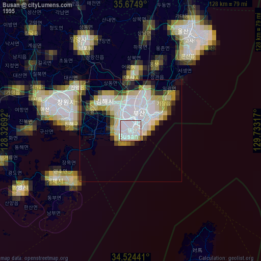
» NASA, Earths city lights 1995
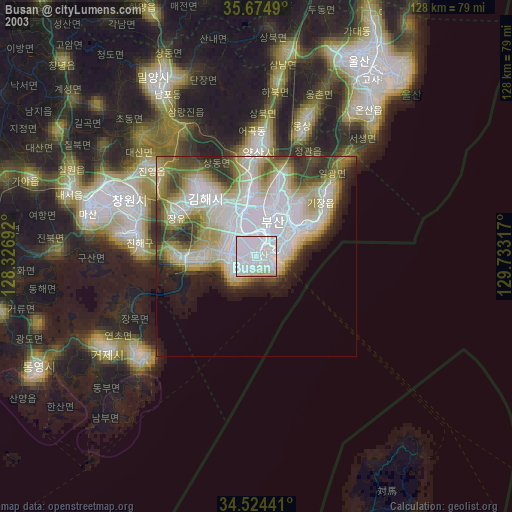
» NASA city lights 2003
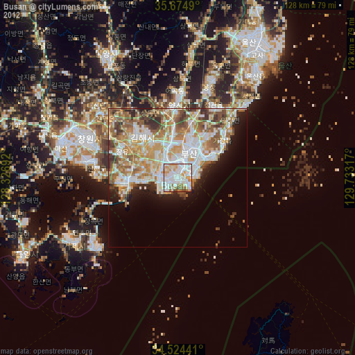
» Earth at Night: Flat Maps 2012, 2016