Gyeongju night lights from space
Night Light of Gyeongju (Gyeongsangbuk-do) from space (South Korea) Src. Average luminocity for 10x10km area is 57.1171% and for 50x50km: 23.4333%.
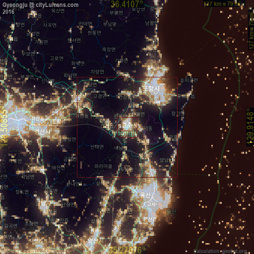
Analysis of Gyeongju night lights 2016
Square area 10x10 km:
 7.17%
7.17%90-99
15.03%80-89
4.37%70-79
5.94%60-69
11.19%50-59
12.24%40-49
10.31%30-39
13.46%20-29
15.73%10-19
4.55%0-9
0%Square area 50x50 km:
2.28%90-99
3.81%80-89
2.37%70-79
3.07%60-69
3.31%50-59
3.74%40-49
3.37%30-39
5.26%20-29
7.21%10-19
19.2%0-9
46.38%Clear (daylight) street map image can be seen on geolist.org.
Map coordinates:
36° 24' 38.5" North, 128° 30' 30.8" East
35° 50' 34" North, 129° 12' 42" East
35° 16' 14.7" North, 129° 54' 53.3" East
Some cities around Gyeongju sort by population:
• Daegu
56 km =34.8 mi,  273°
273°
• Ulsan
35.3 km =21.9 mi,  164°
164°
• Pohang
24.9 km =15.5 mi,  33°
33°
• Ungsang
48.7 km =30.3 mi,  184°
184°
• Eisen
28.8 km =17.9 mi,  298°
298°
• Yeonil
21.1 km =13.1 mi,  36°
36°
• Hayang
36.1 km =22.4 mi,  282°
282°
• Heunghae
32 km =19.9 mi,  22°
22°
1841603 (p: 155,237)
Sources (retrieved 2019-11-25):
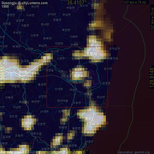
» NASA, Earths city lights 1995
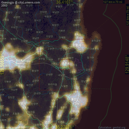
» NASA city lights 2003
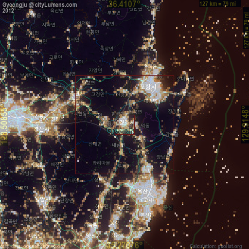
» Earth at Night: Flat Maps 2012, 2016