Ulsan night lights from space
Night Light of Ulsan from space (South Korea) Src. Average luminocity for 10x10km area is 93.4707% and for 50x50km: 32.6847%.
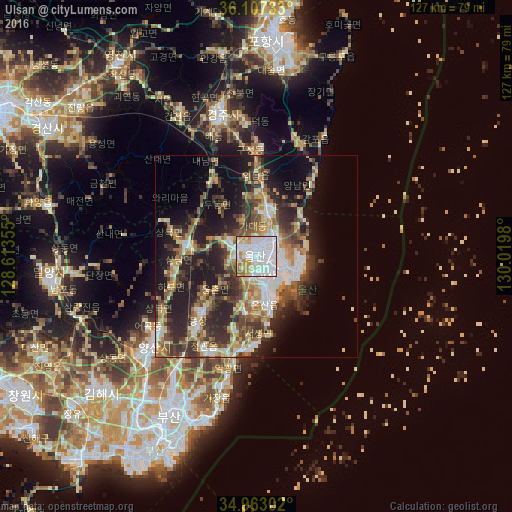
Analysis of Ulsan night lights 2016
Square area 10x10 km:
 51.65%
90-99
26.56%80-89
6.59%70-79
8.97%60-69
4.76%50-59
1.47%40-49
0%30-39
0%20-29
0%10-19
0%0-9
0%Square area 50x50 km:
5.66%90-99
5.92%80-89
3.39%70-79
4.11%60-69
5.04%50-59
4.39%40-49
5.2%30-39
6.79%20-29
9.97%10-19
14.25%0-9
35.28%Clear (daylight) street map image can be seen on geolist.org.
Map coordinates:
36° 6' 26.4" North, 128° 36' 48.8" East
35° 32' 14" North, 129° 19' 0" East
34° 57' 46.9" North, 130° 1' 11.3" East
Some cities around Ulsan sort by population:
• Pohang
54.9 km =34.1 mi,  4°
4°
• Kimhae
51.9 km =32.2 mi,  229°
229°
• Gyeongju
35.3 km =21.9 mi,  344°
344°
• Ungsang
19.8 km =12.3 mi,  222°
222°
• Yangsan
33.6 km =20.9 mi, 229°
• Miryang
51.6 km =32.1 mi,  264°
264°
• Gijang
33.9 km =21.1 mi,  195°
195°
• Yeonil
51 km =31.7 mi, 3°
1833747 (p: 962,865)
Sources (retrieved 2019-11-25):
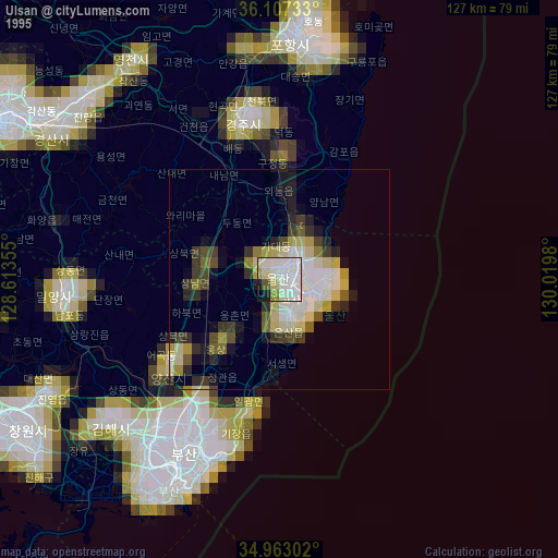
» NASA, Earths city lights 1995
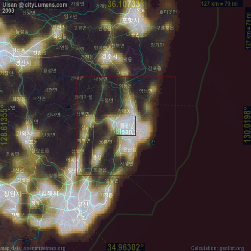
» NASA city lights 2003
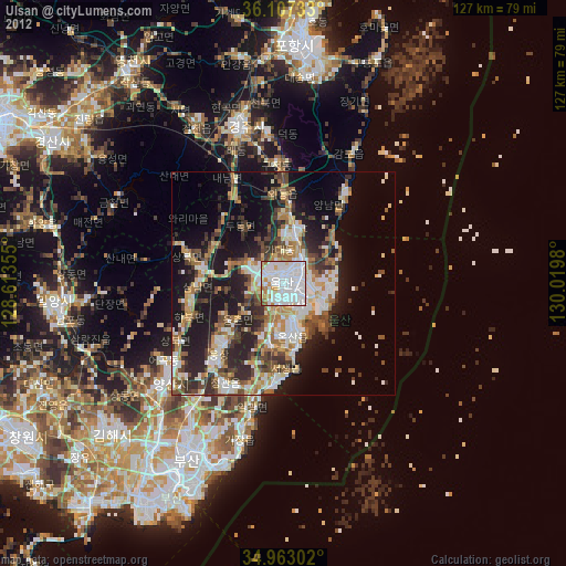
» Earth at Night: Flat Maps 2012, 2016