Ŭiju night lights from space
Night Light of Ŭiju (P'yŏngan-bukto) from space (North Korea) Src. Average luminocity for 10x10km area is 0.1656% and for 50x50km: 5.1021%.
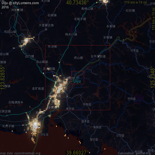
Analysis of Ŭiju night lights 2016
Square area 10x10 km:
 0%
0%90-99
0%80-89
0%70-79
0%60-69
0%50-59
0%40-49
0%30-39
0%20-29
0%10-19
0%0-9
100%Square area 50x50 km:
0.25%90-99
0.33%80-89
1.02%70-79
0.51%60-69
0.89%50-59
1.16%40-49
0.67%30-39
1.47%20-29
1.59%10-19
3.78%0-9
88.32%Clear (daylight) street map image can be seen on geolist.org.
Map coordinates:
40° 44' 3.7" North, 123° 49' 42.8" East
40° 11' 58" North, 124° 31' 54" East
39° 39' 37" North, 125° 14' 5.3" East
Some cities around Ŭiju sort by population:
• Dandong, CN
14 km =8.7 mi,  236°
236°
• Sinŭiju
15.8 km =9.8 mi,  225°
225°
• Fengcheng, CN
48.2 km =30 mi,  305°
305°
• Kuandian, CN
62.6 km =38.9 mi,  19°
19°
• Langtoucun, CN
24.3 km =15.1 mi,  223°
223°
• Kusŏng
65.3 km =40.6 mi,  111°
111°
• Sakchu-ŭp
48.5 km =30.1 mi,  64°
64°
• Yŏmju-ŭp
34.5 km =21.4 mi,  170°
170°
2039623 (p: 50,081)
Sources (retrieved 2019-11-25):
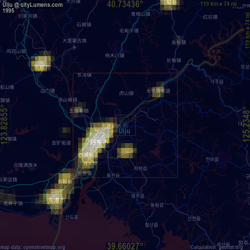
» NASA, Earths city lights 1995
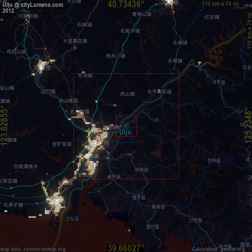
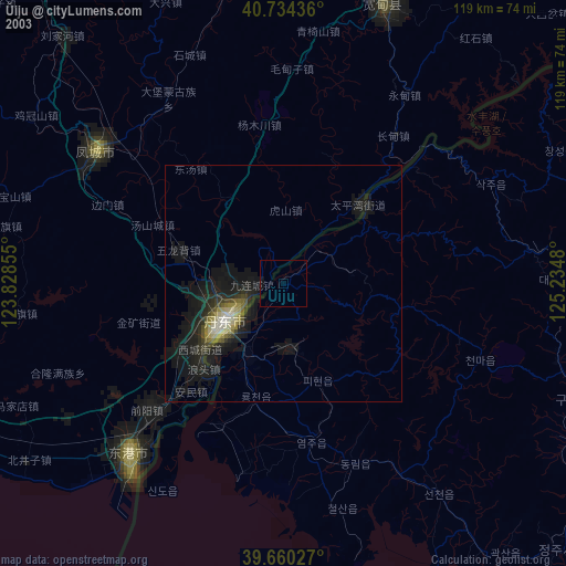
» NASA city lights 2003
» Earth at Night: Flat Maps 2012, 2016