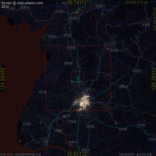
Sunan night lights from space
Night Light of Sunan (Pyongyang) from space (North Korea) Src. Average luminocity for 10x10km area is 0.5162% and for 50x50km: 2.6054%.

Analysis of Sunan night lights 2016
Square area 10x10 km:
 0%
0%90-99
0%80-89
0%70-79
0%60-69
0%50-59
0%40-49
0%30-39
0.65%20-29
0.65%10-19
0.65%0-9
98.05%Square area 50x50 km:
0.02%90-99
0.13%80-89
0.16%70-79
0.5%60-69
0.61%50-59
0.69%40-49
0.47%30-39
0.83%20-29
0.97%10-19
1.75%0-9
93.89%Clear (daylight) street map image can be seen on geolist.org.
Map coordinates:
39° 44' 28" North, 124° 59' 12.8" East
39° 11' 54" North, 125° 41' 24" East
38° 39' 4.8" North, 126° 23' 35.3" East
Some cities around Sunan sort by population:
• Pyongyang
19.1 km =11.9 mi,  163°
163°
• Sunch’ŏn
33.3 km =20.7 mi,  38°
38°
• P’yŏngsŏng
16.6 km =10.3 mi,  71°
71°
• Sŭngho 1-tong
33.9 km =21.1 mi,  132°
132°
• Kangdong-ŭp
35.6 km =22.1 mi,  100°
100°
• Sil-li
37.8 km =23.5 mi,  330°
330°
• Chunghwa
38.4 km =23.9 mi,  165°
165°
• Yonggang-ŭp
44.4 km =27.6 mi,  211°
211°
1869021 (p: 36,671)
Sources (retrieved 2019-11-25):
» Earth at Night: Flat Maps 2012, 2016