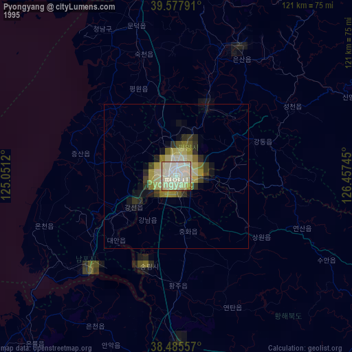
Pyongyang night lights from space
Night Light of Pyongyang from space (North Korea) Src. Average luminocity for 10x10km area is 42.9805% and for 50x50km: 2.65%.
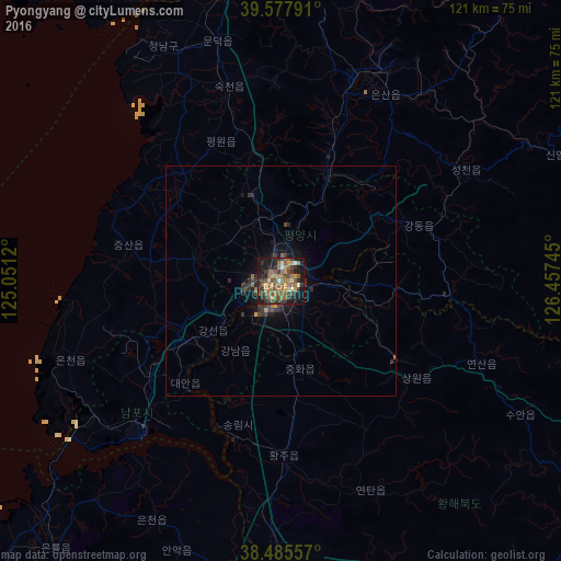
Analysis of Pyongyang night lights 2016
Square area 10x10 km:
 0.49%
0.49%90-99
3.08%80-89
3.41%70-79
8.77%60-69
12.66%50-59
14.94%40-49
7.95%30-39
12.34%20-29
11.04%10-19
21.59%0-9
3.73%Square area 50x50 km:
0.02%90-99
0.13%80-89
0.14%70-79
0.44%60-69
0.61%50-59
0.69%40-49
0.48%30-39
0.93%20-29
1.03%10-19
1.83%0-9
93.72%Clear (daylight) street map image can be seen on geolist.org.
Map coordinates:
39° 34' 40.5" North, 125° 3' 4.3" East
39° 2' 1.9" North, 125° 45' 15.6" East
38° 29' 8.1" North, 126° 27' 26.8" East
Some cities around Pyongyang sort by population:
• Songnim
32.5 km =20.2 mi,  196°
196°
• P’yŏngsŏng
25.7 km =16 mi,  23°
23°
• Sŭngho 1-tong
19.9 km =12.4 mi,  103°
103°
• Sunan
19.1 km =11.9 mi,  343°
343°
• Kangdong-ŭp
31.9 km =19.8 mi,  67°
67°
• Hŭkkyo-ri
26.4 km =16.4 mi,  172°
172°
• Chunghwa
19.3 km =12 mi, 168°
• Yonggang-ŭp
34.7 km =21.6 mi,  235°
235°
1871859 (p: 3,222,000)
Sources (retrieved 2019-11-25):
» NASA, Earths city lights 1995
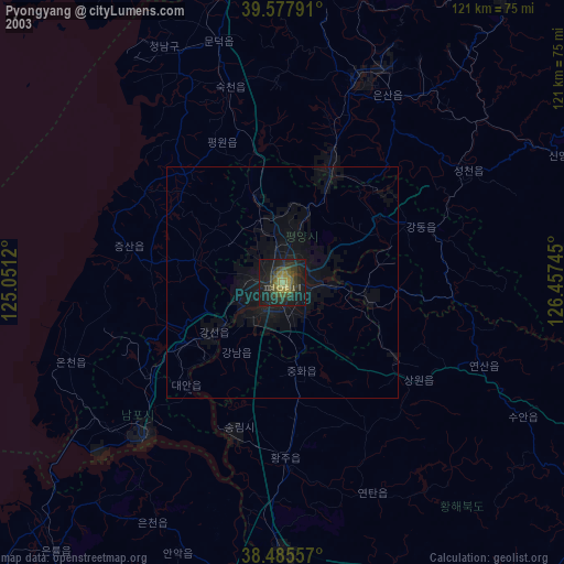
» NASA city lights 2003
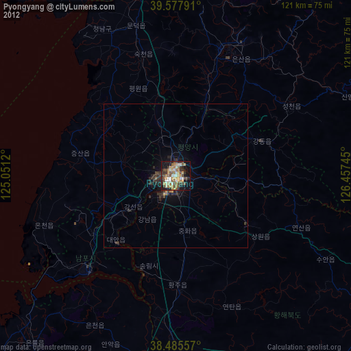
» Earth at Night: Flat Maps 2012, 2016