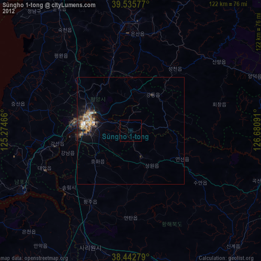
Sŭngho 1-tong night lights from space
Night Light of Sŭngho 1-tong (Pyongyang) from space (North Korea) Src. Average luminocity for 10x10km area is 0% and for 50x50km: 2.4263%.
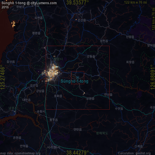
Analysis of Sŭngho 1-tong night lights 2016
Square area 10x10 km:
 0%
0%90-99
0%80-89
0%70-79
0%60-69
0%50-59
0%40-49
0%30-39
0%20-29
0%10-19
0%0-9
100%Square area 50x50 km:
0.02%90-99
0.13%80-89
0.14%70-79
0.44%60-69
0.58%50-59
0.67%40-49
0.44%30-39
0.79%20-29
0.88%10-19
1.68%0-9
94.25%Clear (daylight) street map image can be seen on geolist.org.
Map coordinates:
39° 32' 8.8" North, 125° 16' 28.8" East
38° 59' 29" North, 125° 58' 40" East
38° 26' 34" North, 126° 40' 51.3" East
Some cities around Sŭngho 1-tong sort by population:
• Pyongyang
19.9 km =12.4 mi,  283°
283°
• Songnim
39.1 km =24.3 mi,  227°
227°
• P’yŏngsŏng
29.8 km =18.5 mi,  342°
342°
• Sunan
33.9 km =21.1 mi,  312°
312°
• Hwangju-ŭp
39.7 km =24.7 mi,  206°
206°
• Kangdong-ŭp
19.7 km =12.2 mi,  31°
31°
• Hŭkkyo-ri
26.8 km =16.7 mi,  216°
216°
• Chunghwa
20.9 km =13 mi, 227°
1868998 (p: 39,841)
Sources (retrieved 2019-11-25):
» Earth at Night: Flat Maps 2012, 2016