Yūki night lights from space
Night Light of Yūki (Ibaraki) from space (Japan) Src. Average luminocity for 10x10km area is 51.6206% and for 50x50km: 29.5855%.
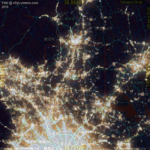
Analysis of Yūki night lights 2016
Square area 10x10 km:
 2.1%
2.1%90-99
10.31%80-89
6.47%70-79
8.04%60-69
8.74%50-59
12.59%40-49
10.49%30-39
13.81%20-29
23.43%10-19
4.02%0-9
0%Square area 50x50 km:
1.33%90-99
3.97%80-89
2.28%70-79
3.47%60-69
5.21%50-59
6.24%40-49
6.5%30-39
8.18%20-29
14.37%10-19
23.85%0-9
24.59%Clear (daylight) street map image can be seen on geolist.org.
Map coordinates:
36° 51' 52.6" North, 139° 10' 48.8" East
36° 18' 0" North, 139° 52' 60" East
35° 43' 52.6" North, 140° 35' 11.3" East
Some cities around Yūki sort by population:
• Oyama
7.5 km =4.7 mi,  270°
270°
• Tochigi
16.3 km =10.1 mi,  304°
304°
• Mooka
19 km =11.8 mi,  38°
38°
• Shimodate
9 km =5.6 mi,  90°
90°
• Koga
19.8 km =12.3 mi,  229°
229°
• Mibu
15 km =9.3 mi,  330°
330°
• Kaminokawa
15.1 km =9.4 mi,  11°
11°
• Makabe
19.8 km =12.3 mi,  100°
100°
1848096 (p: 51,574)
Sources (retrieved 2019-11-25):
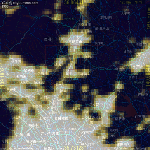
» NASA, Earths city lights 1995
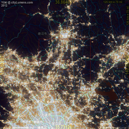
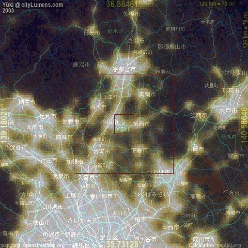
» NASA city lights 2003
» Earth at Night: Flat Maps 2012, 2016