Utsunomiya night lights from space
Night Light of Utsunomiya (Tochigi) from space (Japan) Src. Average luminocity for 10x10km area is 78.3608% and for 50x50km: 19.7657%.
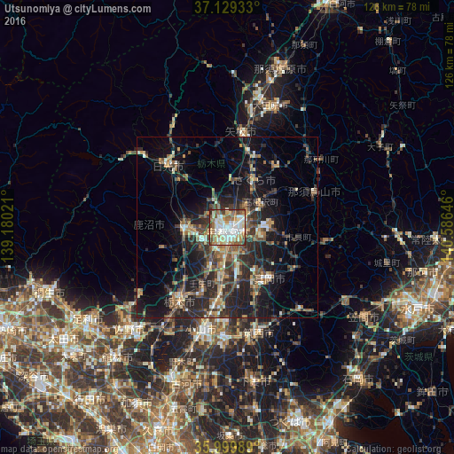
Analysis of Utsunomiya night lights 2016
Square area 10x10 km:
 19.41%
90-99
26.56%80-89
10.07%70-79
7.69%60-69
13.74%50-59
10.62%40-49
7.88%30-39
3.3%20-29
0.73%10-19
0%0-9
0%Square area 50x50 km:
1.34%90-99
2.76%80-89
1.51%70-79
2.35%60-69
3.19%50-59
3.77%40-49
4.1%30-39
4.48%20-29
8.32%10-19
14.26%0-9
53.9%Clear (daylight) street map image can be seen on geolist.org.
Map coordinates:
37° 7' 45.6" North, 139° 10' 48.8" East
36° 34' 0" North, 139° 52' 60" East
35° 59' 59.6" North, 140° 35' 11.3" East
Some cities around Utsunomiya sort by population:
• Kanuma
13.5 km =8.4 mi,  262°
262°
• Tochigi
24.4 km =15.2 mi,  213°
213°
• Mooka
19 km =11.8 mi,  141°
141°
• Imaichi
24.4 km =15.2 mi,  313°
313°
• Mibu
18.3 km =11.4 mi,  204°
204°
• Kaminokawa
15.1 km =9.4 mi,  168°
168°
• Ujiie
15 km =9.3 mi,  29°
29°
• Mashiko
22.3 km =13.9 mi,  119°
119°
1849053 (p: 449,865)
Sources (retrieved 2019-11-25):
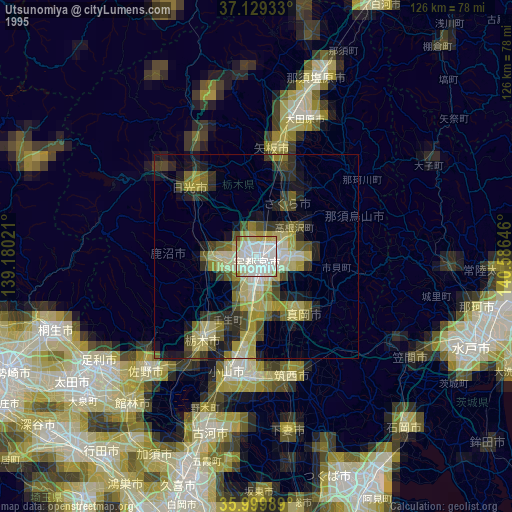
» NASA, Earths city lights 1995
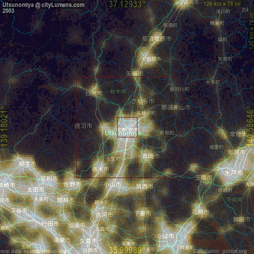
» NASA city lights 2003
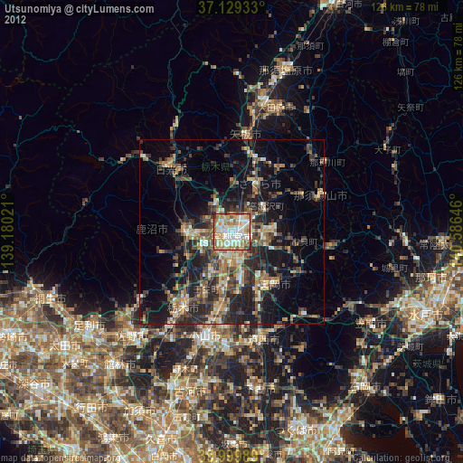
» Earth at Night: Flat Maps 2012, 2016