Imaichi night lights from space
Night Light of Imaichi (Tochigi) from space (Japan) Src. Average luminocity for 10x10km area is 20.2839% and for 50x50km: 10.3688%.
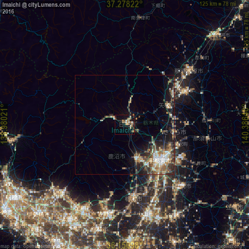
Analysis of Imaichi night lights 2016
Square area 10x10 km:
 0.73%
0.73%90-99
3.3%80-89
1.65%70-79
4.03%60-69
4.03%50-59
3.66%40-49
3.3%30-39
0.37%20-29
4.21%10-19
16.67%0-9
58.06%Square area 50x50 km:
0.96%90-99
1.82%80-89
0.84%70-79
1.4%60-69
1.64%50-59
1.95%40-49
2.17%30-39
1.64%20-29
3.01%10-19
5.65%0-9
78.91%Clear (daylight) street map image can be seen on geolist.org.
Map coordinates:
37° 16' 41.6" North, 138° 58' 48.8" East
36° 43' 0" North, 139° 40' 60" East
36° 9' 3.5" North, 140° 23' 11.3" East
Some cities around Imaichi sort by population:
• Utsunomiya
24.4 km =15.2 mi,  133°
133°
• Kanuma
19.1 km =11.9 mi,  166°
166°
• Tochigi
37.3 km =23.2 mi, 173°
• Ōtawara
35.3 km =21.9 mi,  61°
61°
• Mibu
34.9 km =21.7 mi,  162°
162°
• Yaita
24.1 km =15 mi,  67°
67°
• Ujiie
25.5 km =15.8 mi,  98°
98°
• Nikkō
7 km =4.3 mi,  301°
301°
1861699 (p: 64,323)
Sources (retrieved 2019-11-25):
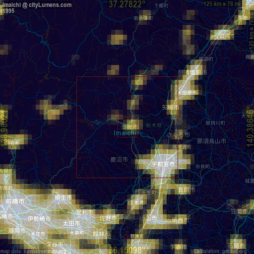
» NASA, Earths city lights 1995
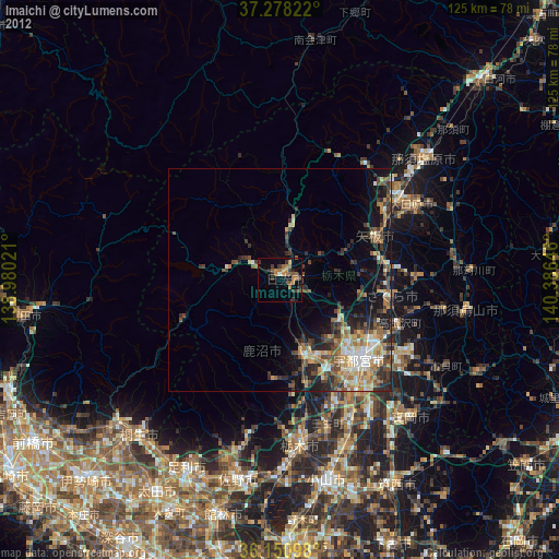
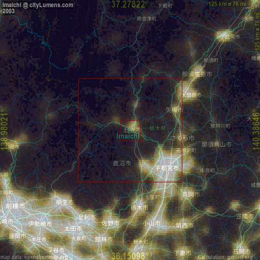
» NASA city lights 2003
» Earth at Night: Flat Maps 2012, 2016