Kogota night lights from space
Night Light of Kogota (Miyagi) from space (Japan) Src. Average luminocity for 10x10km area is 10.1851% and for 50x50km: 11.9093%.
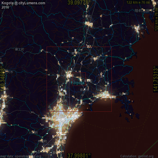
Analysis of Kogota night lights 2016
Square area 10x10 km:
 0.16%
0.16%90-99
0.49%80-89
1.46%70-79
0.65%60-69
1.14%50-59
0.32%40-49
1.79%30-39
1.62%20-29
5.03%10-19
8.44%0-9
78.9%Square area 50x50 km:
0.91%90-99
1.8%80-89
0.85%70-79
1.55%60-69
1.99%50-59
1.94%40-49
1.29%30-39
2.13%20-29
4.45%10-19
9.76%0-9
73.34%Clear (daylight) street map image can be seen on geolist.org.
Map coordinates:
39° 5' 52" North, 140° 20' 48.8" East
38° 33' 0" North, 141° 3' 0" East
37° 59' 52.8" North, 141° 45' 11.3" East
Some cities around Kogota sort by population:
• Ishinomaki
26.3 km =16.3 mi,  124°
124°
• Furukawa
8.6 km =5.3 mi,  286°
286°
• Shiogama
26 km =16.2 mi,  183°
183°
• Tomiya
22.5 km =14 mi,  219°
219°
• Rifu
25.2 km =15.7 mi,  194°
194°
• Yamoto
19.8 km =12.3 mi,  133°
133°
• Wakuya
7.4 km =4.6 mi,  94°
94°
• Matsushima
19.6 km =12.2 mi, 177°
2112182 (p: 19,760)
Sources (retrieved 2019-11-25):
» Earth at Night: Flat Maps 2012, 2016