Furukawa night lights from space
Night Light of Furukawa (Miyagi) from space (Japan) Src. Average luminocity for 10x10km area is 29.6656% and for 50x50km: 8.162%.
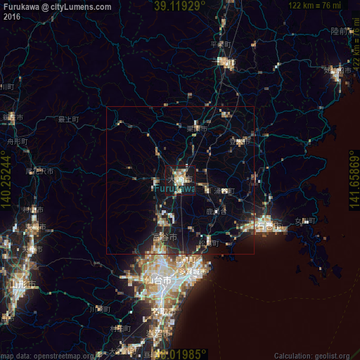
Analysis of Furukawa night lights 2016
Square area 10x10 km:
 2.44%
2.44%90-99
6.01%80-89
5.19%70-79
3.73%60-69
4.22%50-59
2.44%40-49
2.92%30-39
0.97%20-29
4.06%10-19
45.78%0-9
22.24%Square area 50x50 km:
0.43%90-99
1.08%80-89
0.57%70-79
0.81%60-69
1.4%50-59
1.17%40-49
0.95%30-39
1.41%20-29
3.6%10-19
7.79%0-9
80.79%Clear (daylight) street map image can be seen on geolist.org.
Map coordinates:
39° 7' 9.4" North, 140° 15' 8.8" East
38° 34' 18" North, 140° 57' 20" East
38° 1' 11.5" North, 141° 39' 31.3" East
Some cities around Furukawa sort by population:
• Ishinomaki
34.6 km =21.5 mi,  119°
119°
• Shiogama
29.2 km =18.1 mi,  166°
166°
• Tomiya
20.8 km =12.9 mi,  196°
196°
• Rifu
26.8 km =16.7 mi,  176°
176°
• Yamoto
27.7 km =17.2 mi,  125°
125°
• Kogota
8.6 km =5.3 mi,  106°
106°
• Wakuya
15.9 km =9.9 mi,  100°
100°
• Matsushima
23.9 km =14.9 mi,  157°
157°
2112899 (p: 76,312)
Sources (retrieved 2019-11-25):
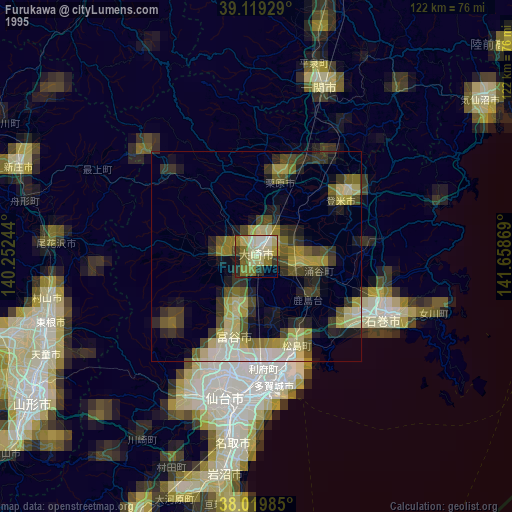
» NASA, Earths city lights 1995
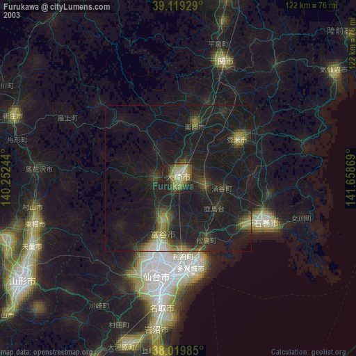
» NASA city lights 2003
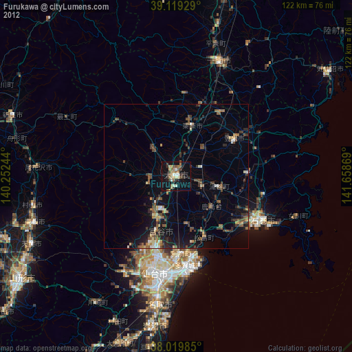
» Earth at Night: Flat Maps 2012, 2016