Tōkamachi night lights from space
Night Light of Tōkamachi (Niigata) from space (Japan) Src. Average luminocity for 10x10km area is 3.1701% and for 50x50km: 1.3807%.
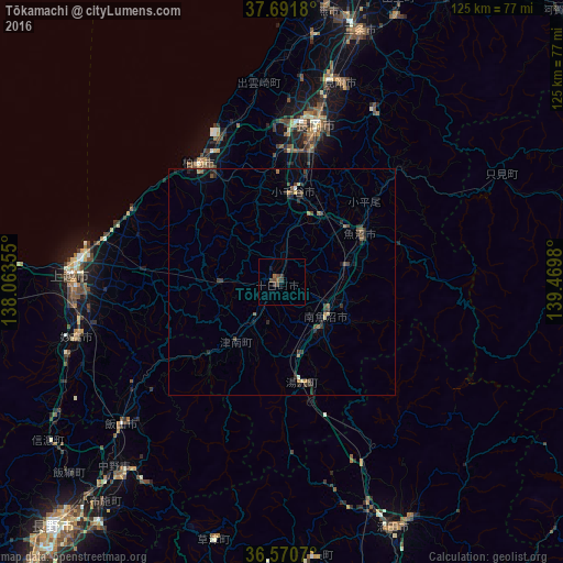
Analysis of Tōkamachi night lights 2016
Square area 10x10 km:
 0%
0%90-99
0%80-89
0%70-79
0%60-69
0%50-59
1.36%40-49
2.72%30-39
2.04%20-29
0%10-19
0.68%0-9
93.2%Square area 50x50 km:
0%90-99
0.05%80-89
0.14%70-79
0.1%60-69
0.19%50-59
0.28%40-49
0.42%30-39
0.57%20-29
0.71%10-19
0.25%0-9
97.29%Clear (daylight) street map image can be seen on geolist.org.
Map coordinates:
37° 41' 30.5" North, 138° 3' 48.8" East
37° 7' 60" North, 138° 46' 0" East
36° 34' 14.5" North, 139° 28' 11.3" East
Some cities around Tōkamachi sort by population:
• Jōetsu
47 km =29.2 mi,  272°
272°
• Nagaoka
36 km =22.4 mi,  11°
11°
• Kashiwazaki
32.3 km =20.1 mi,  323°
323°
• Mitsuke
46.9 km =29.1 mi,  18°
18°
• Ojiya
18.8 km =11.7 mi, 9°
• Muikamachi
12.7 km =7.9 mi,  125°
125°
• Tochio-honchō
43.2 km =26.8 mi,  27°
27°
• Shiozawa
12.9 km =8 mi,  145°
145°
1850217 (p: 41,136)
Sources (retrieved 2019-11-25):
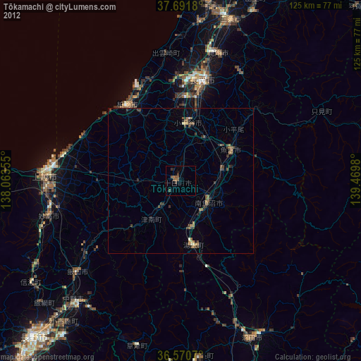
» Earth at Night: Flat Maps 2012, 2016