Tochio-honchō night lights from space
Night Light of Tochio-honchō (Niigata) from space (Japan) Src. Average luminocity for 10x10km area is 2.8734% and for 50x50km: 4.982%.
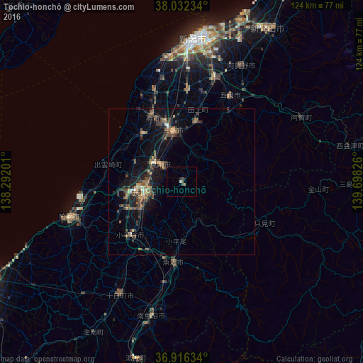
Analysis of Tochio-honchō night lights 2016
Square area 10x10 km:
 0%
0%90-99
0.65%80-89
0%70-79
0%60-69
0.65%50-59
0.65%40-49
1.3%30-39
0%20-29
0.81%10-19
0.49%0-9
95.45%Square area 50x50 km:
0.12%90-99
0.31%80-89
0.39%70-79
0.4%60-69
0.9%50-59
1.06%40-49
1.57%30-39
1.37%20-29
1.38%10-19
3.76%0-9
88.74%Clear (daylight) street map image can be seen on geolist.org.
Map coordinates:
38° 1' 56.4" North, 138° 17' 31.2" East
37° 28' 35.1" North, 138° 59' 42.5" East
36° 54' 58.8" North, 139° 41' 53.7" East
Some cities around Tochio-honchō sort by population:
• Nagaoka
13.1 km =8.1 mi,  257°
257°
• Sanjō
16.1 km =10 mi,  345°
345°
• Tsubame
21.8 km =13.5 mi,  343°
343°
• Mitsuke
8.4 km =5.2 mi,  319°
319°
• Ojiya
26.1 km =16.2 mi,  221°
221°
• Kamo
21.2 km =13.2 mi,  9°
9°
• Yoshida-kasugachō
25 km =15.5 mi, 336°
• Muramatsu
28.6 km =17.8 mi,  32°
32°
1850307 (p: 23,045)
Sources (retrieved 2019-11-25):
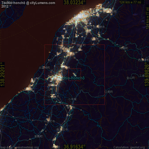
» Earth at Night: Flat Maps 2012, 2016