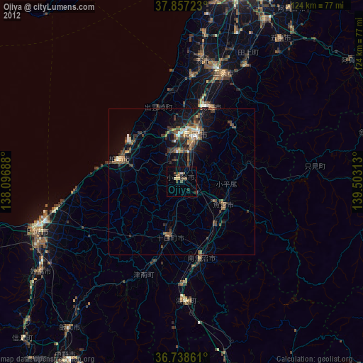
Ojiya night lights from space
Night Light of Ojiya (Niigata) from space (Japan) Src. Average luminocity for 10x10km area is 7.6104% and for 50x50km: 4.4736%.

Analysis of Ojiya night lights 2016
Square area 10x10 km:
 0%
0%90-99
0.65%80-89
1.3%70-79
0%60-69
1.62%50-59
0.65%40-49
2.76%30-39
2.27%20-29
4.06%10-19
0%0-9
86.69%Square area 50x50 km:
0.1%90-99
0.39%80-89
0.33%70-79
0.36%60-69
0.69%50-59
0.92%40-49
1.44%30-39
1.23%20-29
1.33%10-19
3.4%0-9
89.8%Clear (daylight) street map image can be seen on geolist.org.
Map coordinates:
37° 51' 26" North, 138° 5' 48.8" East
37° 18' 0" North, 138° 48' 0" East
36° 44' 19" North, 139° 30' 11.3" East
Some cities around Ojiya sort by population:
• Nagaoka
17.3 km =10.7 mi,  14°
14°
• Kashiwazaki
23.3 km =14.5 mi,  288°
288°
• Sanjō
37.6 km =23.4 mi,  20°
20°
• Mitsuke
28.5 km =17.7 mi, 24°
• Tōkamachi
18.8 km =11.7 mi,  189°
189°
• Muikamachi
27 km =16.8 mi,  164°
164°
• Tochio-honchō
26.1 km =16.2 mi,  41°
41°
• Shiozawa
29.5 km =18.3 mi,  171°
171°
1854444 (p: 40,549)
Sources (retrieved 2019-11-25):
» Earth at Night: Flat Maps 2012, 2016