Nagaoka night lights from space
Night Light of Nagaoka (Niigata) from space (Japan) Src. Average luminocity for 10x10km area is 34.6607% and for 50x50km: 5.5674%.
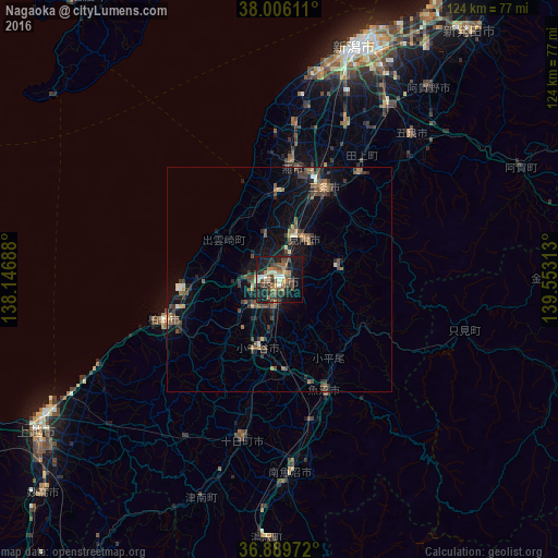
Analysis of Nagaoka night lights 2016
Square area 10x10 km:
 1.79%
1.79%90-99
4.22%80-89
3.41%70-79
2.92%60-69
8.28%50-59
7.63%40-49
9.58%30-39
6.66%20-29
9.58%10-19
32.14%0-9
13.8%Square area 50x50 km:
0.14%90-99
0.44%80-89
0.44%70-79
0.48%60-69
0.94%50-59
1.19%40-49
1.7%30-39
1.44%20-29
1.63%10-19
3.98%0-9
87.62%Clear (daylight) street map image can be seen on geolist.org.
Map coordinates:
38° 0' 22" North, 138° 8' 48.8" East
37° 27' 0" North, 138° 51' 0" East
36° 53' 23" North, 139° 33' 11.3" East
Some cities around Nagaoka sort by population:
• Kashiwazaki
28.1 km =17.5 mi,  250°
250°
• Sanjō
20.5 km =12.7 mi,  25°
25°
• Tsubame
24.8 km =15.4 mi,  15°
15°
• Mitsuke
11.8 km =7.3 mi,  38°
38°
• Ojiya
17.3 km =10.7 mi,  194°
194°
• Kamo
28.9 km =18 mi, 34°
• Yoshida-kasugachō
26.1 km =16.2 mi,  6°
6°
• Tochio-honchō
13.1 km =8.1 mi,  77°
77°
1856199 (p: 195,318)
Sources (retrieved 2019-11-25):
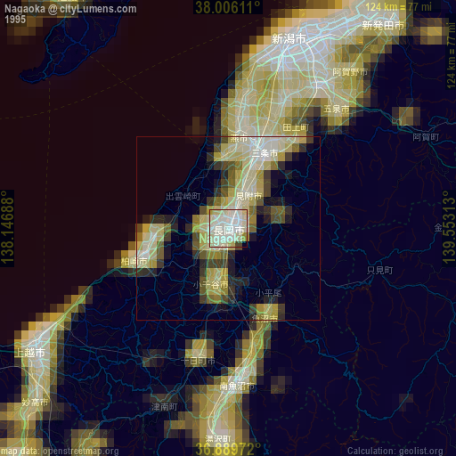
» NASA, Earths city lights 1995
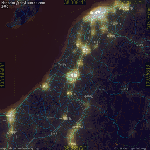
» NASA city lights 2003
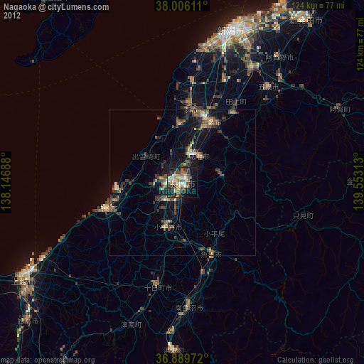
» Earth at Night: Flat Maps 2012, 2016