Ōta night lights from space
Night Light of Ōta (Gunma) from space (Japan) Src. Average luminocity for 10x10km area is 72.3164% and for 50x50km: 39.1905%.
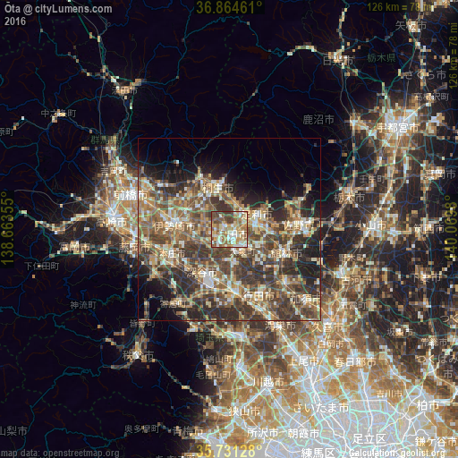
Analysis of Ōta night lights 2016
Square area 10x10 km:
 8.92%
8.92%90-99
20.28%80-89
12.24%70-79
12.24%60-69
16.43%50-59
11.89%40-49
13.46%30-39
4.55%20-29
0%10-19
0%0-9
0%Square area 50x50 km:
2.34%90-99
6.61%80-89
5.19%70-79
5.56%60-69
7.3%50-59
9.2%40-49
10.59%30-39
10.43%20-29
9.89%10-19
8.43%0-9
24.48%Clear (daylight) street map image can be seen on geolist.org.
Map coordinates:
36° 51' 52.6" North, 138° 39' 48.8" East
36° 18' 0" North, 139° 22' 0" East
35° 43' 52.6" North, 140° 4' 11.3" East
Some cities around Ōta sort by population:
• Ashikaga
8.3 km =5.2 mi,  63°
63°
• Isesaki
15 km =9.3 mi,  277°
277°
• Kiryū
11.5 km =7.1 mi,  344°
344°
• Fukayachō
13.4 km =8.3 mi,  213°
213°
• Tatebayashi
15.9 km =9.9 mi,  110°
110°
• Sakai-nakajima
11.1 km =6.9 mi,  250°
250°
• Menuma
8.7 km =5.4 mi,  170°
170°
• Ōmamachō-ōmama
16.8 km =10.4 mi,  330°
330°
1853677 (p: 152,104)
Sources (retrieved 2019-11-25):
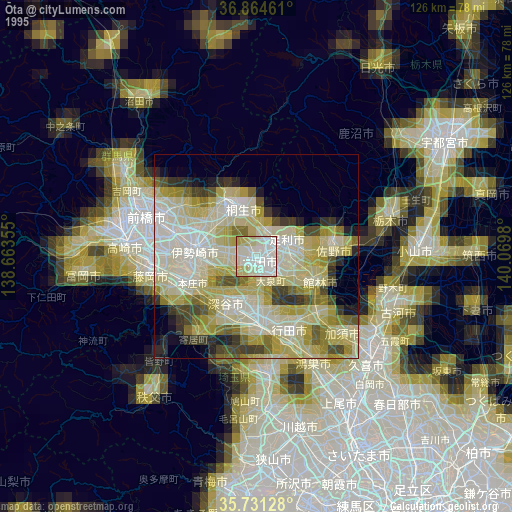
» NASA, Earths city lights 1995
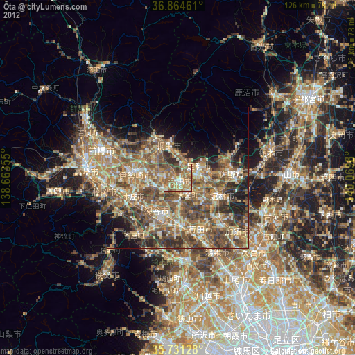
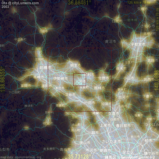
» NASA city lights 2003
» Earth at Night: Flat Maps 2012, 2016