Tanashichō night lights from space
Night Light of Tanashichō (Tokyo) from space (Japan) Src. Average luminocity for 10x10km area is 99.3357% and for 50x50km: 87.592%.
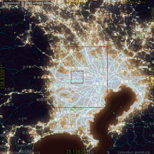
Analysis of Tanashichō night lights 2016
Square area 10x10 km:
 75.7%
75.7%90-99
23.08%80-89
1.22%70-79
0%60-69
0%50-59
0%40-49
0%30-39
0%20-29
0%10-19
0%0-9
0%Square area 50x50 km:
47.97%90-99
20.53%80-89
7.67%70-79
6.79%60-69
6.5%50-59
3.31%40-49
2.16%30-39
1.73%20-29
1.32%10-19
1.42%0-9
0.59%Clear (daylight) street map image can be seen on geolist.org.
Map coordinates:
36° 17' 52.7" North, 138° 50' 6" East
35° 43' 45.2" North, 139° 32' 17.3" East
35° 9' 23" North, 140° 14' 28.5" East
Some cities around Tanashichō sort by population:
• Tokorozawa
10 km =6.2 mi,  321°
321°
• Chōfu
7.8 km =4.8 mi,  173°
173°
• Nishi-Tokyo-shi
0.4 km =0.2 mi,  178°
178°
• Kamirenjaku
4.2 km =2.6 mi,  158°
158°
• Higashimurayama
6.9 km =4.3 mi,  294°
294°
• Musashino
3.2 km =2 mi,  143°
143°
• Asaka
10.2 km =6.3 mi,  34°
34°
• Kokubunji
6.4 km =4 mi,  242°
242°
1850693 (p: 82,112)
Sources (retrieved 2019-11-25):
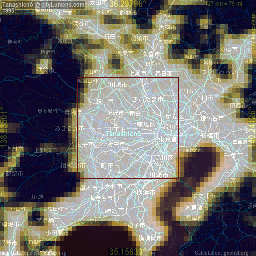
» NASA, Earths city lights 1995
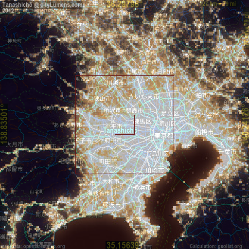
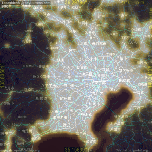
» NASA city lights 2003
» Earth at Night: Flat Maps 2012, 2016