Asaka night lights from space
Night Light of Asaka (Saitama) from space (Japan) Src. Average luminocity for 10x10km area is 97.3706% and for 50x50km: 87.058%.
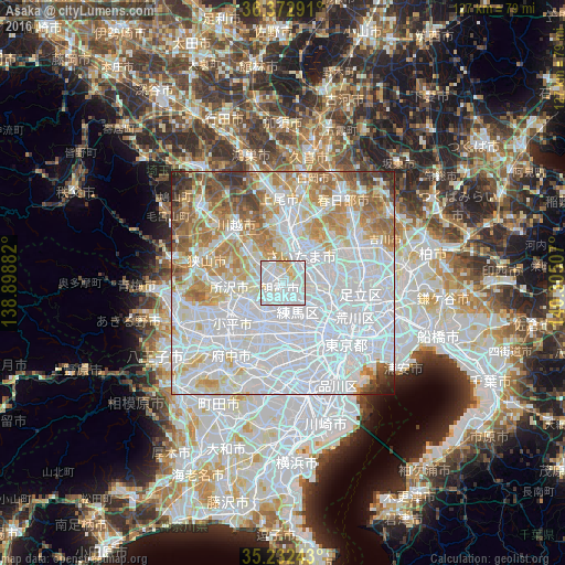
Analysis of Asaka night lights 2016
Square area 10x10 km:
 58.92%
90-99
30.77%80-89
8.04%70-79
2.27%60-69
0%50-59
0%40-49
0%30-39
0%20-29
0%10-19
0%0-9
0%Square area 50x50 km:
45.37%90-99
19.46%80-89
7.99%70-79
7.47%60-69
8.6%50-59
4.84%40-49
2.83%30-39
2.07%20-29
1.15%10-19
0.22%0-9
0.01%Clear (daylight) street map image can be seen on geolist.org.
Map coordinates:
36° 22' 22.5" North, 138° 53' 55.8" East
35° 48' 17" North, 139° 36' 7" East
35° 13' 56.7" North, 140° 18' 18.3" East
Some cities around Asaka sort by population:
• Yono
9.2 km =5.7 mi,  17°
17°
• Kawaguchi
9.8 km =6.1 mi,  89°
89°
• Nishi-Tokyo-shi
10.5 km =6.5 mi,  213°
213°
• Shimotoda
7.6 km =4.7 mi,  81°
81°
• Tanashichō
10.2 km =6.3 mi, 214°
• Wako
2.6 km =1.6 mi,  131°
131°
• Shiki
3.6 km =2.2 mi,  332°
332°
• Ōi
9 km =5.6 mi,  304°
304°
1907299 (p: 128,058)
Sources (retrieved 2019-11-25):
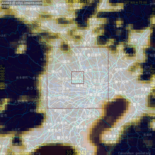
» NASA, Earths city lights 1995
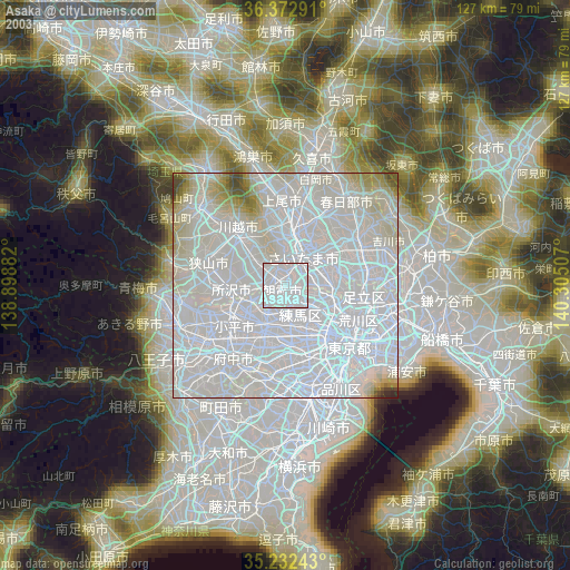
» NASA city lights 2003
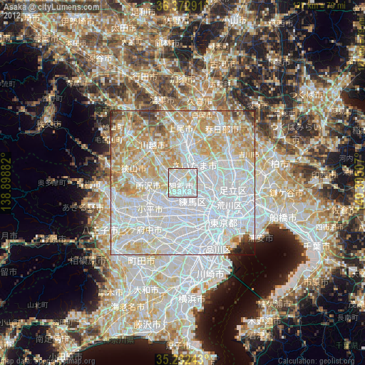
» Earth at Night: Flat Maps 2012, 2016