Suzaka night lights from space
Night Light of Suzaka (Nagano) from space (Japan) Src. Average luminocity for 10x10km area is 18.7711% and for 50x50km: 7.1013%.
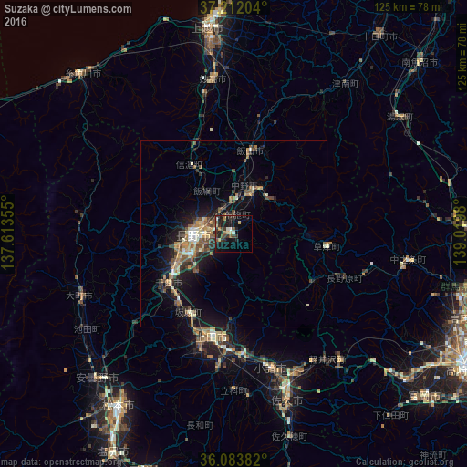
Analysis of Suzaka night lights 2016
Square area 10x10 km:
 0.37%
0.37%90-99
2.56%80-89
0.73%70-79
2.75%60-69
2.56%50-59
3.48%40-49
2.56%30-39
5.49%20-29
7.88%10-19
22.16%0-9
49.45%Square area 50x50 km:
0.29%90-99
0.94%80-89
0.64%70-79
0.97%60-69
1.24%50-59
1.42%40-49
1.26%30-39
1.16%20-29
2.14%10-19
6.05%0-9
83.9%Clear (daylight) street map image can be seen on geolist.org.
Map coordinates:
37° 12' 43.3" North, 137° 36' 48.8" East
36° 39' 0" North, 138° 19' 0" East
36° 5' 1.8" North, 139° 1' 11.3" East
Some cities around Suzaka sort by population:
• Nagano
11.9 km =7.4 mi,  270°
270°
• Ueda
27.7 km =17.2 mi,  186°
186°
• Komoro
38.5 km =23.9 mi,  164°
164°
• Nakano
12 km =7.5 mi,  21°
21°
• Arai
39.8 km =24.7 mi,  348°
348°
• Kamimaruko
37 km =23 mi, 186°
• Iiyama
22.7 km =14.1 mi,  11°
11°
• Hakuba
40.9 km =25.4 mi,  277°
277°
1851357 (p: 54,022)
Sources (retrieved 2019-11-25):
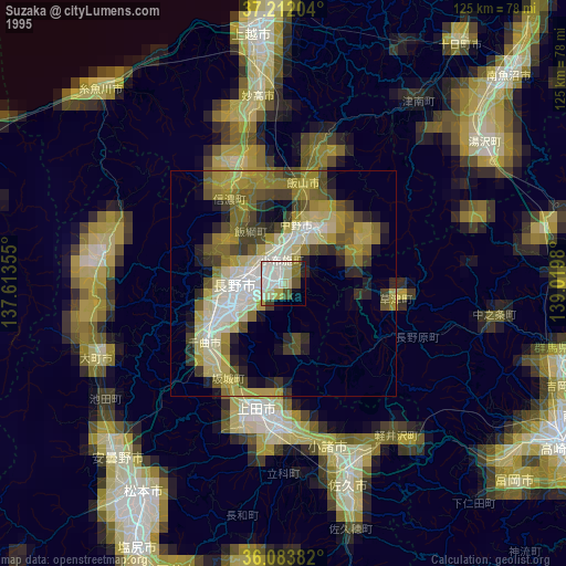
» NASA, Earths city lights 1995
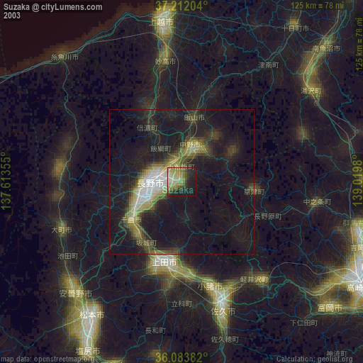
» NASA city lights 2003
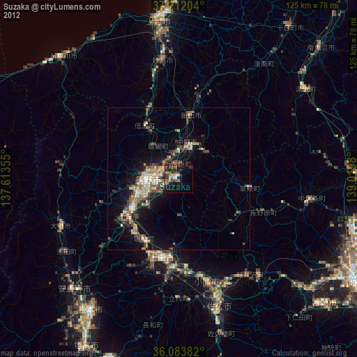
» Earth at Night: Flat Maps 2012, 2016