Kamimaruko night lights from space
Night Light of Kamimaruko (Nagano) from space (Japan) Src. Average luminocity for 10x10km area is 11.9878% and for 50x50km: 6.3364%.
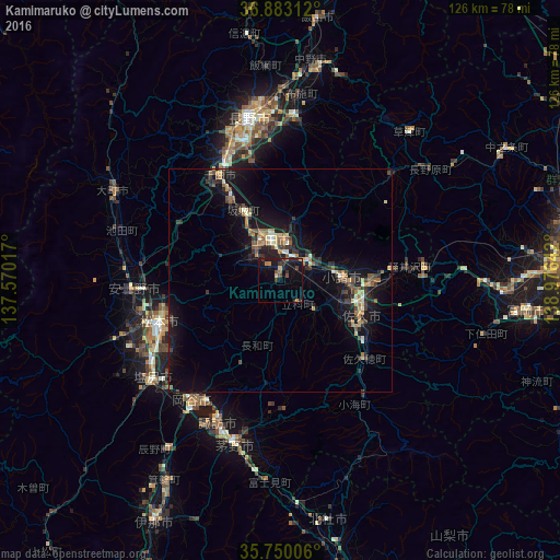

Analysis of Kamimaruko night lights 2016
Square area 10x10 km:
 0%
0%90-99
0%80-89
1.4%70-79
1.22%60-69
2.27%50-59
2.1%40-49
1.4%30-39
2.8%20-29
5.24%10-19
18.88%0-9
64.69%Square area 50x50 km:
0.11%90-99
0.66%80-89
0.7%70-79
0.76%60-69
0.95%50-59
0.97%40-49
0.86%30-39
1.3%20-29
2.02%10-19
7.16%0-9
84.51%Clear (daylight) street map image can be seen on geolist.org.
Map coordinates:
36° 52' 59.2" North, 137° 34' 12.6" East
36° 19' 7.1" North, 138° 16' 23.8" East
35° 45' 0.2" North, 138° 58' 35.1" East
Some cities around Kamimaruko sort by population:
• Matsumoto
29.1 km =18.1 mi,  250°
250°
• Ueda
9.4 km =5.8 mi,  4°
4°
• Saku
22 km =13.7 mi,  121°
121°
• Suwa
34.4 km =21.4 mi,  204°
204°
• Okaya
35.6 km =22.1 mi,  215°
215°
• Komoro
14.3 km =8.9 mi,  90°
90°
• Hotaka
35.1 km =21.8 mi,  273°
273°
• Toyoshina
33.4 km =20.8 mi, 266°
1857659 (p: 25,403)
Sources (retrieved 2019-11-25):
» Earth at Night: Flat Maps 2012, 2016