Seto night lights from space
Night Light of Seto (Aichi) from space (Japan) Src. Average luminocity for 10x10km area is 52.1906% and for 50x50km: 49.6909%.
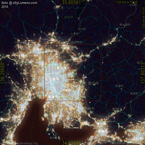
Analysis of Seto night lights 2016
Square area 10x10 km:
 5.77%
5.77%90-99
5.24%80-89
8.04%70-79
9.62%60-69
12.94%50-59
13.46%40-49
7.87%30-39
5.77%20-29
15.91%10-19
14.51%0-9
0.87%Square area 50x50 km:
16.28%90-99
12.08%80-89
6.21%70-79
6.05%60-69
5.44%50-59
4.55%40-49
3.97%30-39
3.68%20-29
6.59%10-19
6.12%0-9
29.02%Clear (daylight) street map image can be seen on geolist.org.
Map coordinates:
35° 48' 20.2" North, 136° 23' 48.8" East
35° 13' 60" North, 137° 6' 0" East
34° 39' 25.1" North, 137° 48' 11.3" East
Some cities around Seto sort by population:
• Nagoya
18.5 km =11.5 mi,  251°
251°
• Toyota
17.3 km =10.7 mi,  164°
164°
• Kasugai
11.7 km =7.3 mi,  277°
277°
• Komaki
17.5 km =10.9 mi,  288°
288°
• Tajimi
9.7 km =6 mi,  18°
18°
• Toki
15 km =9.3 mi,  30°
30°
• Mizunami
20.1 km =12.5 mi,  42°
42°
• Mitake
20.6 km =12.8 mi,  8°
8°
1852663 (p: 134,246)
Sources (retrieved 2019-11-25):
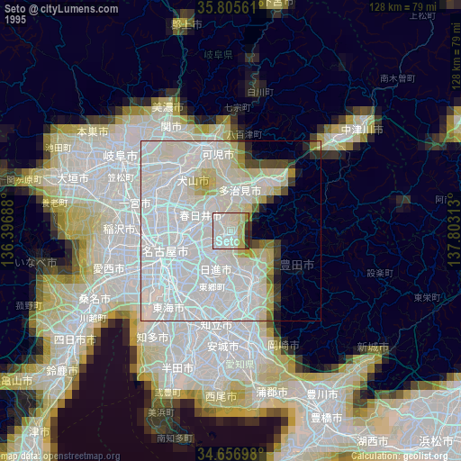
» NASA, Earths city lights 1995
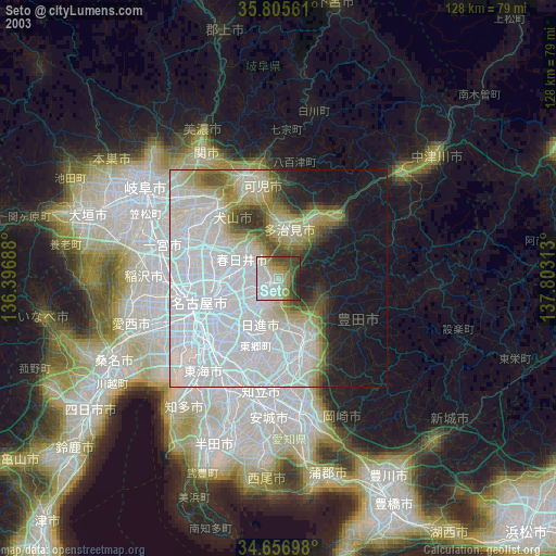
» NASA city lights 2003
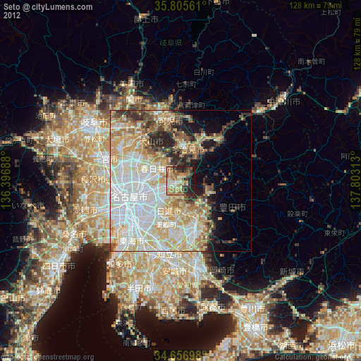
» Earth at Night: Flat Maps 2012, 2016