Satte night lights from space
Night Light of Satte (Saitama) from space (Japan) Src. Average luminocity for 10x10km area is 63.3315% and for 50x50km: 56.0846%.
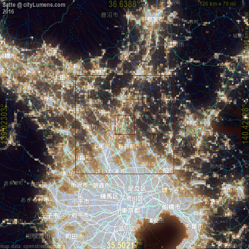
Analysis of Satte night lights 2016
Square area 10x10 km:
 3.3%
3.3%90-99
11.9%80-89
6.59%70-79
8.79%60-69
25.64%50-59
17.22%40-49
17.22%30-39
5.49%20-29
3.85%10-19
0%0-9
0%Square area 50x50 km:
8.51%90-99
11.32%80-89
6.85%70-79
8.31%60-69
11.74%50-59
8.78%40-49
9.61%30-39
9.96%20-29
11.38%10-19
13.24%0-9
0.29%Clear (daylight) street map image can be seen on geolist.org.
Map coordinates:
36° 38' 19.7" North, 139° 1' 22.9" East
36° 4' 21.1" North, 139° 43' 34.1" East
35° 30' 7.8" North, 140° 25' 45.4" East
Some cities around Satte sort by population:
• Kasukabe
10.2 km =6.3 mi,  168°
168°
• Iwatsuki
12.3 km =7.6 mi,  192°
192°
• Kukichūō
4.6 km =2.9 mi,  262°
262°
• Shiraoka
8.4 km =5.2 mi,  224°
224°
• Sugito
4.6 km =2.9 mi,  179°
179°
• Kurihashi
7.2 km =4.5 mi,  340°
340°
• Sakai
7.3 km =4.5 mi,  65°
65°
• Shōbu
11.4 km =7.1 mi,  266°
266°
1852849 (p: 55,286)
Sources (retrieved 2019-11-25):
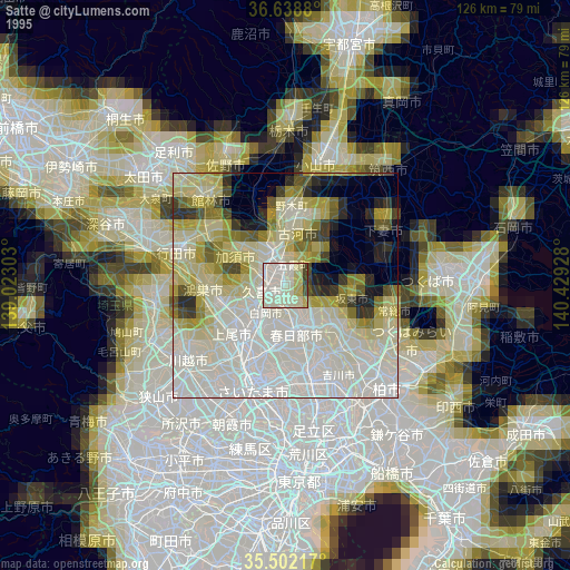
» NASA, Earths city lights 1995
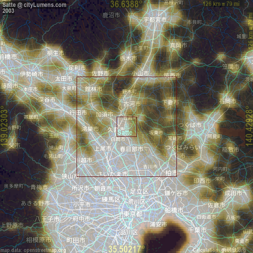
» NASA city lights 2003
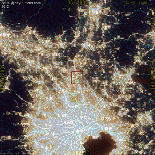
» Earth at Night: Flat Maps 2012, 2016