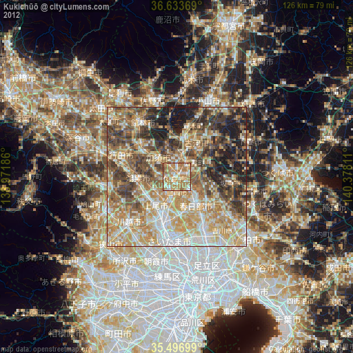
Kukichūō night lights from space
Night Light of Kukichūō (Saitama) from space (Japan) Src. Average luminocity for 10x10km area is 73.4469% and for 50x50km: 57.7665%.


Analysis of Kukichūō night lights 2016
Square area 10x10 km:
 7.88%
7.88%90-99
13.92%80-89
10.07%70-79
15.02%60-69
37%50-59
13.37%40-49
2.01%30-39
0.73%20-29
0%10-19
0%0-9
0%Square area 50x50 km:
8.63%90-99
11.47%80-89
7.24%70-79
8.59%60-69
12.61%50-59
9.53%40-49
10%30-39
10.92%20-29
10.95%10-19
9.99%0-9
0.07%Clear (daylight) street map image can be seen on geolist.org.
Map coordinates:
36° 38' 1.3" North, 138° 58' 18.7" East
36° 4' 2.6" North, 139° 40' 29.9" East
35° 29' 49.2" North, 140° 22' 41.2" East
Some cities around Kukichūō sort by population:
• Kazo
8.7 km =5.4 mi,  309°
309°
• Hasuda
11 km =6.8 mi,  192°
192°
• Satte
4.6 km =2.9 mi,  82°
82°
• Shiraoka
5.6 km =3.5 mi, 193°
• Sugito
6.1 km =3.8 mi,  131°
131°
• Kurihashi
7.7 km =4.8 mi,  17°
17°
• Shōbu
6.7 km =4.2 mi,  269°
269°
• Kisai
9 km =5.6 mi,  293°
293°
1858445 (p: 73,373)
Sources (retrieved 2019-11-25):
» NASA, Earths city lights 1995
» NASA city lights 2003
» Earth at Night: Flat Maps 2012, 2016