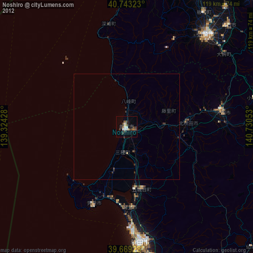
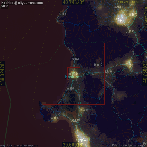
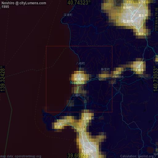
Noshiro night lights from space
Night Light of Noshiro (Akita) from space (Japan) Src. Average luminocity for 10x10km area is 10.7094% and for 50x50km: 0.566%.
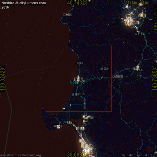
Analysis of Noshiro night lights 2016
Square area 10x10 km:
 0.49%
0.49%90-99
0.32%80-89
1.62%70-79
0.81%60-69
3.25%50-59
0.65%40-49
2.6%30-39
2.92%20-29
5.36%10-19
0.97%0-9
81.01%Square area 50x50 km:
0.02%90-99
0.03%80-89
0.1%70-79
0.03%60-69
0.13%50-59
0.08%40-49
0.1%30-39
0.14%20-29
0.29%10-19
0.07%0-9
99%Clear (daylight) street map image can be seen on geolist.org.
Map coordinates:
40° 44' 35.6" North, 139° 19' 27.4" East
40° 12' 30.2" North, 140° 1' 38.6" East
39° 40' 9.4" North, 140° 43' 49.9" East
Some cities around Noshiro sort by population:
• Akita
55.2 km =34.3 mi,  172°
172°
• Hirosaki
57 km =35.4 mi,  41°
41°
• Ōdate
45.5 km =28.3 mi,  81°
81°
• Kuroishi
67.7 km =42.1 mi, 44°
• Hanawa
64.6 km =40.1 mi,  92°
92°
• Tennō
34.7 km =21.6 mi,  188°
188°
• Namioka
73.4 km =45.6 mi, 40°
• Takanosu
28.8 km =17.9 mi, 86°
2128867 (p: 51,079)
Sources (retrieved 2019-11-25):
» NASA, Earths city lights 1995
» NASA city lights 2003
» Earth at Night: Flat Maps 2012, 2016