Namioka night lights from space
Night Light of Namioka (Aomori) from space (Japan) Src. Average luminocity for 10x10km area is 8.7127% and for 50x50km: 8.1308%.
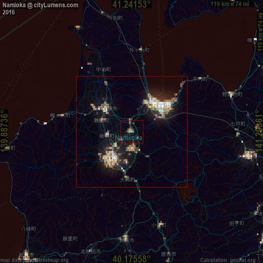

Analysis of Namioka night lights 2016
Square area 10x10 km:
 0%
0%90-99
0%80-89
0%70-79
1.46%60-69
1.79%50-59
2.92%40-49
1.3%30-39
1.46%20-29
2.6%10-19
2.92%0-9
85.55%Square area 50x50 km:
0.87%90-99
1.23%80-89
0.6%70-79
0.81%60-69
1.42%50-59
1.34%40-49
1.04%30-39
1.08%20-29
2.63%10-19
6.74%0-9
82.24%Clear (daylight) street map image can be seen on geolist.org.
Map coordinates:
41° 14' 29.5" North, 139° 53' 14.5" East
40° 42' 38.5" North, 140° 35' 25.7" East
40° 10' 32.1" North, 141° 17' 37" East
Some cities around Namioka sort by population:
• Aomori
16.8 km =10.4 mi,  45°
45°
• Hirosaki
16.4 km =10.2 mi,  217°
217°
• Ōdate
48.9 km =30.4 mi,  183°
183°
• Goshogawara
16.3 km =10.1 mi,  309°
309°
• Kuroishi
7.2 km =4.5 mi, 184°
• Hanawa
60.9 km =37.8 mi,  164°
164°
• Takanosu
57.5 km =35.7 mi,  199°
199°
• Shimokizukuri
21.6 km =13.4 mi,  302°
302°
2129005 (p: 20,681)
Sources (retrieved 2019-11-25):
» Earth at Night: Flat Maps 2012, 2016