Narutō night lights from space
Night Light of Narutō (Chiba) from space (Japan) Src. Average luminocity for 10x10km area is 18.6259% and for 50x50km: 20.4388%.
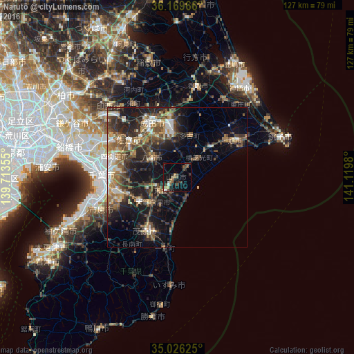
Analysis of Narutō night lights 2016
Square area 10x10 km:
100  0.87%
0.87%
90-99 1.92%
80-89 0.87%
70-79 2.62%
60-69 2.62%
50-59 3.32%
40-49 5.42%
30-39 2.97%
20-29 3.15%
10-19 20.45%
0-9 55.77%
0.87%90-99
1.92%80-89
0.87%70-79
2.62%60-69
2.62%50-59
3.32%40-49
5.42%30-39
2.97%20-29
3.15%10-19
20.45%0-9
55.77%Square area 50x50 km:
100 1.78%
90-99 2.87%
80-89 1.73%
70-79 2.46%
60-69 3.32%
50-59 3.81%
40-49 4.86%
30-39 4.68%
20-29 7.49%
10-19 12.83%
0-9 54.17%
1.78%90-99
2.87%80-89
1.73%70-79
2.46%60-69
3.32%50-59
3.81%40-49
4.86%30-39
4.68%20-29
7.49%10-19
12.83%0-9
54.17%Clear (daylight) street map image can be seen on geolist.org.
Map coordinates:
36° 10' 10.8" North, 139° 42' 48.8" East
35° 36' 0" North, 140° 25' 0" East
35° 1' 34.5" North, 141° 7' 11.3" East
Some cities around Narutō sort by population:
• Sakura
21 km =13 mi,  308°
308°
• Narita
22.3 km =13.9 mi,  336°
336°
• Mobara
22.2 km =13.8 mi,  209°
209°
• Yachimata
10.6 km =6.6 mi,  301°
301°
• Tōgane
7.2 km =4.5 mi,  219°
219°
• Ōami
12.9 km =8 mi, 224°
• Yōkaichiba
16.4 km =10.2 mi,  47°
47°
• Shisui
18.8 km =11.7 mi, 313°
2111677 (p: 25,696)
Sources (retrieved 2019-11-25):
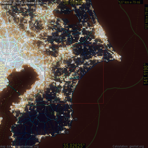
» Earth at Night: Flat Maps 2012, 2016