Motomiya night lights from space
Night Light of Motomiya (Fukushima) from space (Japan) Src. Average luminocity for 10x10km area is 19.4935% and for 50x50km: 8.0515%.
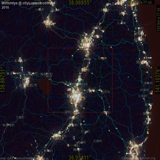
Analysis of Motomiya night lights 2016
Square area 10x10 km:
 1.79%
1.79%90-99
2.76%80-89
1.3%70-79
2.11%60-69
2.76%50-59
1.62%40-49
2.92%30-39
2.6%20-29
6.17%10-19
25.16%0-9
50.81%Square area 50x50 km:
0.65%90-99
1.39%80-89
0.82%70-79
0.97%60-69
1.03%50-59
1.05%40-49
1.31%30-39
1.56%20-29
3.06%10-19
5.73%0-9
82.43%Clear (daylight) street map image can be seen on geolist.org.
Map coordinates:
38° 4' 10.4" North, 139° 41' 51" East
37° 30' 50.1" North, 140° 24' 2.3" East
36° 57' 14.8" North, 141° 6' 13.5" East
Some cities around Motomiya sort by population:
• Kōriyama
12.8 km =8 mi,  186°
186°
• Fukushima
26.9 km =16.7 mi,  12°
12°
• Sukagawa
25.7 km =16 mi,  183°
183°
• Nihommatsu
8.2 km =5.1 mi,  20°
20°
• Hobaramachi
36.1 km =22.4 mi, 21°
• Funehikimachi-funehiki
17.2 km =10.7 mi,  115°
115°
• Miharu
11.6 km =7.2 mi,  140°
140°
• Inawashiro
25.7 km =16 mi,  283°
283°
2111824 (p: 22,705)
Sources (retrieved 2019-11-25):
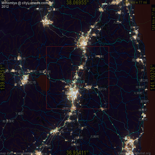
» Earth at Night: Flat Maps 2012, 2016