Kōriyama night lights from space
Night Light of Kōriyama (Fukushima) from space (Japan) Src. Average luminocity for 10x10km area is 62.849% and for 50x50km: 7.9892%.
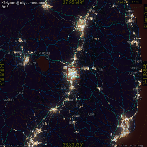

Analysis of Kōriyama night lights 2016
Square area 10x10 km:
 9.9%
9.9%90-99
18.67%80-89
7.79%70-79
11.85%60-69
9.74%50-59
7.95%40-49
6.49%30-39
6.01%20-29
10.06%10-19
11.36%0-9
0.16%Square area 50x50 km:
0.62%90-99
1.44%80-89
0.78%70-79
1.03%60-69
1.03%50-59
1.08%40-49
1.25%30-39
1.44%20-29
2.81%10-19
5.24%0-9
83.29%Clear (daylight) street map image can be seen on geolist.org.
Map coordinates:
37° 57' 23.4" North, 139° 40' 48.8" East
37° 24' 0" North, 140° 22' 60" East
36° 50' 21.7" North, 141° 5' 11.3" East
Some cities around Kōriyama sort by population:
• Fukushima
39.6 km =24.6 mi,  10°
10°
• Sukagawa
13 km =8.1 mi,  180°
180°
• Nihommatsu
20.9 km =13 mi, 12°
• Funehikimachi-funehiki
17.9 km =11.1 mi,  72°
72°
• Motomiya
12.8 km =8 mi, 6°
• Miharu
9.6 km =6 mi, 67°
• Ishikawa
28.4 km =17.6 mi,  168°
168°
• Inawashiro
29.9 km =18.6 mi,  308°
308°
2112141 (p: 340,560)
Sources (retrieved 2019-11-25):
» NASA, Earths city lights 1995
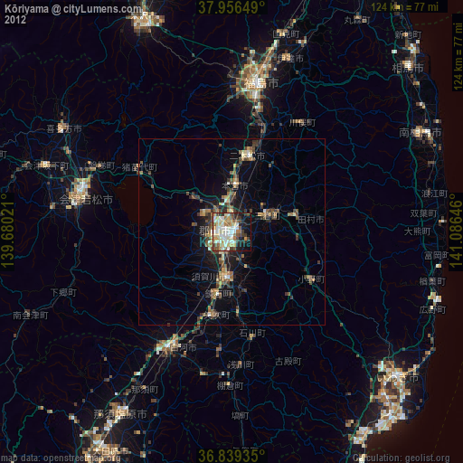
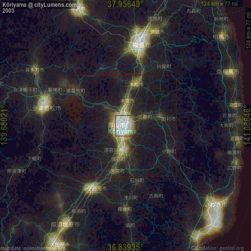
» NASA city lights 2003
» Earth at Night: Flat Maps 2012, 2016