Maruoka night lights from space
Night Light of Maruoka (Fukui) from space (Japan) Src. Average luminocity for 10x10km area is 22.0897% and for 50x50km: 9.2268%.
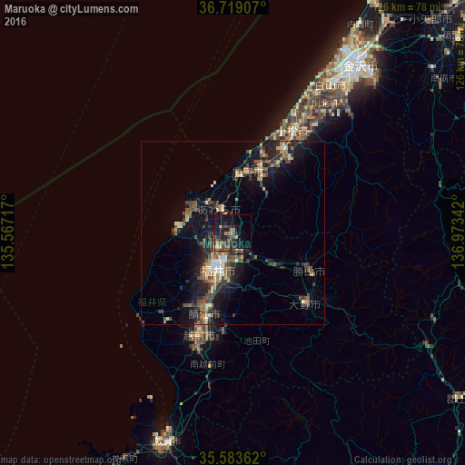
Analysis of Maruoka night lights 2016
Square area 10x10 km:
100  0%
0%
90-99 0.73%
80-89 1.83%
70-79 1.65%
60-69 6.59%
50-59 3.85%
40-49 7.33%
30-39 4.95%
20-29 8.97%
10-19 24.54%
0-9 39.56%
0%90-99
0.73%80-89
1.83%70-79
1.65%60-69
6.59%50-59
3.85%40-49
7.33%30-39
4.95%20-29
8.97%10-19
24.54%0-9
39.56%Square area 50x50 km:
100 0.42%
90-99 0.86%
80-89 0.91%
70-79 0.98%
60-69 1.47%
50-59 1.65%
40-49 2.57%
30-39 1.75%
20-29 3.43%
10-19 7.84%
0-9 78.13%
0.42%90-99
0.86%80-89
0.91%70-79
0.98%60-69
1.47%50-59
1.65%40-49
2.57%30-39
1.75%20-29
3.43%10-19
7.84%0-9
78.13%Clear (daylight) street map image can be seen on geolist.org.
Map coordinates:
36° 43' 8.7" North, 135° 34' 1.8" East
36° 9' 12.2" North, 136° 16' 13" East
35° 35' 1" North, 136° 58' 24.3" East
Some cities around Maruoka sort by population:
• Fukui-shi
10.8 km =6.7 mi,  203°
203°
• Komatsu
32.1 km =19.9 mi,  30°
30°
• Takefu
29.3 km =18.2 mi, 198°
• Sabae
24.3 km =15.1 mi, 198°
• Ono
27.3 km =17 mi,  134°
134°
• Katsuyama
23.1 km =14.4 mi,  116°
116°
• Mikuni
12.8 km =8 mi,  303°
303°
• Asahi
24 km =14.9 mi,  213°
213°
1857651 (p: 33,563)
Sources (retrieved 2019-11-25):
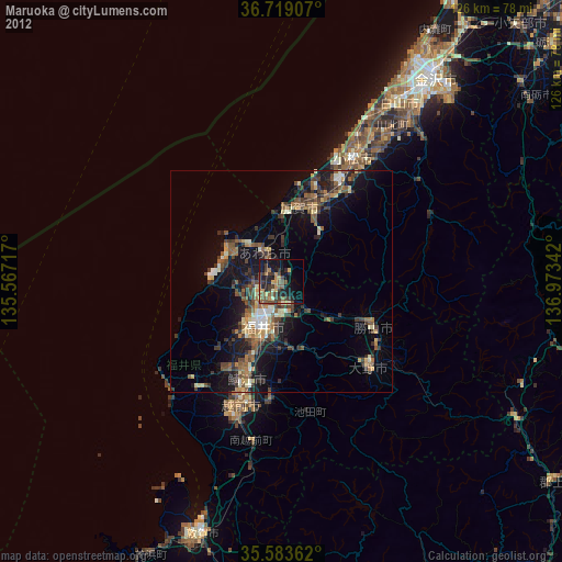
» Earth at Night: Flat Maps 2012, 2016