Kōnan night lights from space
Night Light of Kōnan (Aichi) from space (Japan) Src. Average luminocity for 10x10km area is 77.9817% and for 50x50km: 55.2521%.
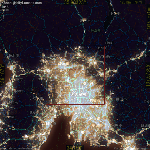
Analysis of Kōnan night lights 2016
Square area 10x10 km:
 10.99%
90-99
15.75%80-89
10.62%70-79
29.49%60-69
26.92%50-59
5.86%40-49
0.37%30-39
0%20-29
0%10-19
0%0-9
0%Square area 50x50 km:
13.66%90-99
10.37%80-89
6.32%70-79
7.61%60-69
9.64%50-59
9.81%40-49
6.45%30-39
5.86%20-29
10.57%10-19
8.28%0-9
11.45%Clear (daylight) street map image can be seen on geolist.org.
Map coordinates:
35° 54' 11.6" North, 136° 10' 2.3" East
35° 19' 53.9" North, 136° 52' 13.5" East
34° 45' 21.6" North, 137° 34' 24.8" East
Some cities around Kōnan sort by population:
• Ichinomiya
7.3 km =4.5 mi,  241°
241°
• Komaki
6.8 km =4.2 mi,  142°
142°
• Kakamigahara
9.5 km =5.9 mi,  357°
357°
• Inazawa
12 km =7.5 mi,  221°
221°
• Inuyama
8.5 km =5.3 mi,  50°
50°
• Iwakura
5.4 km =3.4 mi,  183°
183°
• Kuroda
8.2 km =5.1 mi,  284°
284°
• Kasamatsuchō
10.2 km =6.3 mi,  292°
292°
1858836 (p: 100,389)
Sources (retrieved 2019-11-25):
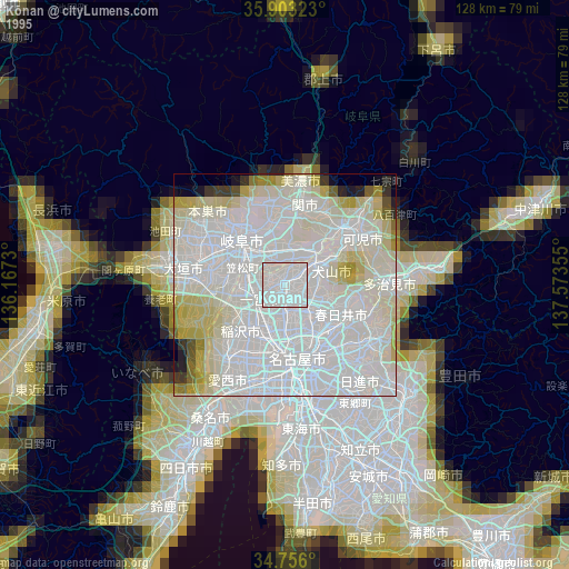
» NASA, Earths city lights 1995
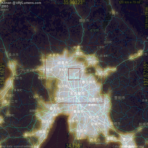
» NASA city lights 2003
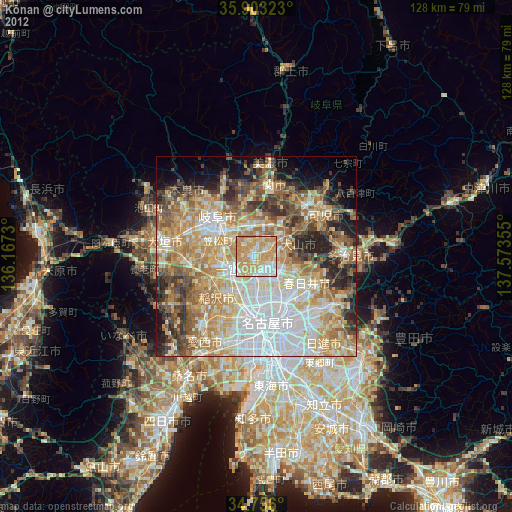
» Earth at Night: Flat Maps 2012, 2016