Iwakura night lights from space
Night Light of Iwakura (Aichi) from space (Japan) Src. Average luminocity for 10x10km area is 90.9213% and for 50x50km: 63.4188%.
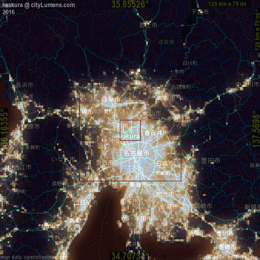
Analysis of Iwakura night lights 2016
Square area 10x10 km:
100  30.07%
90-99 35.14%
80-89 11.54%
70-79 17.83%
60-69 5.42%
50-59 0%
40-49 0%
30-39 0%
20-29 0%
10-19 0%
0-9 0%
30.07%90-99
35.14%80-89
11.54%70-79
17.83%60-69
5.42%50-59
0%40-49
0%30-39
0%20-29
0%10-19
0%0-9
0%Square area 50x50 km:
100 16.61%
90-99 12.82%
80-89 7.49%
70-79 8.9%
60-69 10.76%
50-59 10.43%
40-49 6.85%
30-39 5.97%
20-29 10.23%
10-19 7.37%
0-9 2.57%
16.61%90-99
12.82%80-89
7.49%70-79
8.9%60-69
10.76%50-59
10.43%40-49
6.85%30-39
5.97%20-29
10.23%10-19
7.37%0-9
2.57%Clear (daylight) street map image can be seen on geolist.org.
Map coordinates:
35° 51' 18.9" North, 136° 9' 48.8" East
35° 16' 60" North, 136° 52' 0" East
34° 42' 26.4" North, 137° 34' 11.3" East
Some cities around Iwakura sort by population:
• Nagoya
11.9 km =7.4 mi,  162°
162°
• Kasugai
10.4 km =6.5 mi,  112°
112°
• Ichinomiya
6.3 km =3.9 mi,  287°
287°
• Komaki
4.5 km =2.8 mi,  90°
90°
• Inazawa
8.4 km =5.2 mi,  243°
243°
• Kōnan
5.4 km =3.4 mi,  3°
3°
• Inuyama
12.8 km =8 mi,  32°
32°
• Kuroda
10.6 km =6.6 mi,  314°
314°
1861207 (p: 48,007)
Sources (retrieved 2019-11-25):
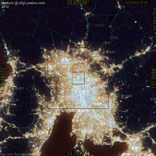
» Earth at Night: Flat Maps 2012, 2016