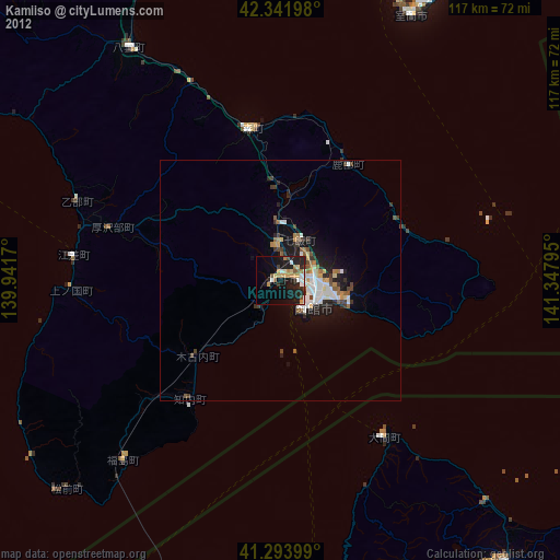
Kamiiso night lights from space
Night Light of Kamiiso (Hokkaido) from space (Japan) Src. Average luminocity for 10x10km area is 23.6848% and for 50x50km: 5.6273%.
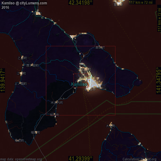
Analysis of Kamiiso night lights 2016
Square area 10x10 km:
 0.91%
0.91%90-99
2.42%80-89
4.09%70-79
3.79%60-69
1.67%50-59
3.03%40-49
4.85%30-39
5.15%20-29
15%10-19
17.73%0-9
41.36%Square area 50x50 km:
0.74%90-99
1.12%80-89
0.68%70-79
0.57%60-69
0.56%50-59
0.65%40-49
0.74%30-39
1%20-29
2.08%10-19
3.71%0-9
88.13%Clear (daylight) street map image can be seen on geolist.org.
Map coordinates:
42° 20' 31.1" North, 139° 56' 30.1" East
41° 49' 12.5" North, 140° 38' 41.4" East
41° 17' 38.4" North, 141° 20' 52.6" East
Some cities around Kamiiso sort by population:
• Aomori
111.8 km =69.5 mi,  176°
176°
• Hakodate
9.1 km =5.7 mi,  122°
122°
• Muroran
62.1 km =38.6 mi,  27°
27°
• Mutsu
75.8 km =47.1 mi,  141°
141°
• Date
74.4 km =46.2 mi,  14°
14°
• Honchō
9.2 km =5.7 mi, 26°
• Shiraoi
99.8 km =62 mi,  35°
35°
• Shimokizukuri
113.9 km =70.8 mi,  191°
191°
2129766 (p: 38,098)
Sources (retrieved 2019-11-25):
» Earth at Night: Flat Maps 2012, 2016