Hakodate night lights from space
Night Light of Hakodate (Hokkaido) from space (Japan) Src. Average luminocity for 10x10km area is 54.7971% and for 50x50km: 5.701%.
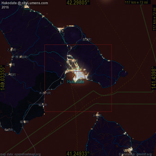
Analysis of Hakodate night lights 2016
Square area 10x10 km:
 15.91%
90-99
18.83%80-89
4.87%70-79
4.55%60-69
1.3%50-59
2.27%40-49
2.6%30-39
6.66%20-29
17.69%10-19
20.94%0-9
4.38%Square area 50x50 km:
0.75%90-99
1.13%80-89
0.72%70-79
0.57%60-69
0.53%50-59
0.63%40-49
0.82%30-39
1.06%20-29
2.06%10-19
3.76%0-9
87.97%Clear (daylight) street map image can be seen on geolist.org.
Map coordinates:
42° 17' 53" North, 140° 2' 0.8" East
41° 46' 33" North, 140° 44' 12" East
41° 14' 57.6" North, 141° 26' 23.3" East
Some cities around Hakodate sort by population:
• Aomori
106.6 km =66.2 mi,  180°
180°
• Muroran
63.7 km =39.6 mi,  19°
19°
• Mutsu
67.3 km =41.8 mi,  143°
143°
• Goshogawara
110.8 km =68.8 mi,  192°
192°
• Kamiiso
9.1 km =5.7 mi,  302°
302°
• Date
77.7 km =48.3 mi,  8°
8°
• Honchō
13.7 km =8.5 mi,  344°
344°
• Shiraoi
99.8 km =62 mi,  30°
30°
2130188 (p: 275,730)
Sources (retrieved 2019-11-25):
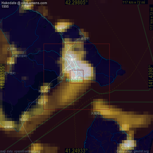
» NASA, Earths city lights 1995
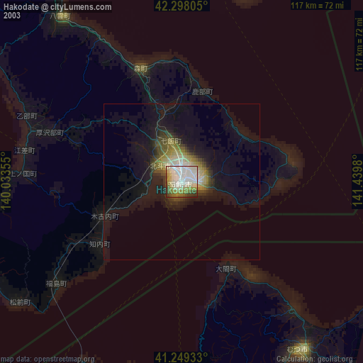
» NASA city lights 2003
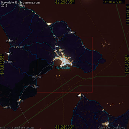
» Earth at Night: Flat Maps 2012, 2016