Shiraoi night lights from space
Night Light of Shiraoi (Hokkaido) from space (Japan) Src. Average luminocity for 10x10km area is 9.5952% and for 50x50km: 4.247%.
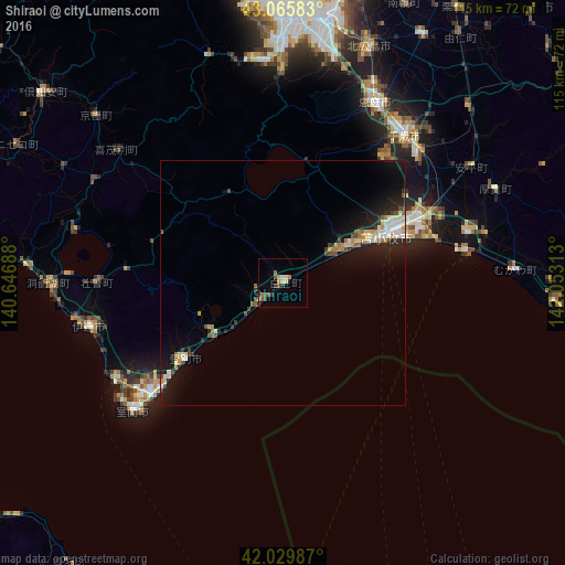
Analysis of Shiraoi night lights 2016
Square area 10x10 km:
 0%
0%90-99
1.27%80-89
1.75%70-79
1.27%60-69
2.06%50-59
0.63%40-49
3.17%30-39
2.06%20-29
0.79%10-19
0.32%0-9
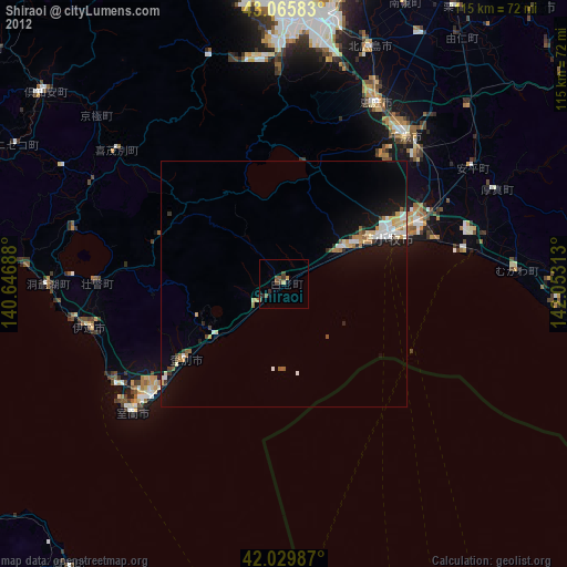
86.67%Square area 50x50 km:
0.37%90-99
0.8%80-89
0.47%70-79
0.52%60-69
0.52%50-59
0.34%40-49
0.63%30-39
0.52%20-29
1.25%10-19
3.65%0-9
90.93%Clear (daylight) street map image can be seen on geolist.org.
Map coordinates:
43° 3' 57" North, 140° 38' 48.8" East
42° 33' 0" North, 141° 21' 0" East
42° 1' 47.5" North, 142° 3' 11.3" East
Some cities around Shiraoi sort by population:
• Sapporo
57.4 km =35.7 mi,  0°
0°
• Tomakomai
22.9 km =14.2 mi,  65°
65°
• Ebetsu
64.2 km =39.9 mi,  14°
14°
• Muroran
39.4 km =24.5 mi,  228°
228°
• Chitose
38.8 km =24.1 mi,  39°
39°
• Kitahiroshima
50.6 km =31.4 mi,  20°
20°
• Date
40.5 km =25.2 mi,  257°
257°
• Tōbetsu
75.4 km =46.9 mi, 10°
2128072 (p: 20,804)
Sources (retrieved 2019-11-25):
» Earth at Night: Flat Maps 2012, 2016