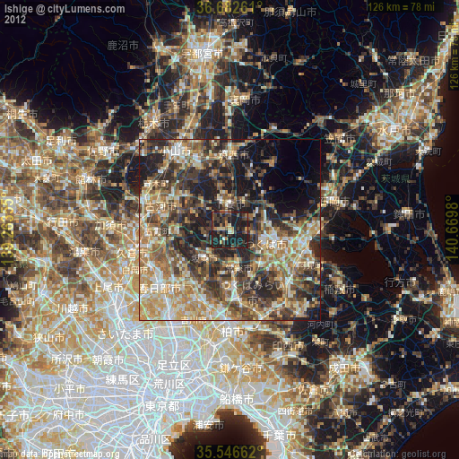
Ishige night lights from space
Night Light of Ishige (Ibaraki) from space (Japan) Src. Average luminocity for 10x10km area is 26.8022% and for 50x50km: 40.5057%.
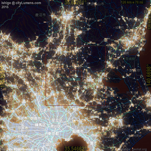
Analysis of Ishige night lights 2016
Square area 10x10 km:
100  0.92%
0.92%
90-99 3.3%
80-89 0.92%
70-79 2.75%
60-69 0.73%
50-59 3.48%
40-49 8.06%
30-39 5.86%
20-29 15.93%
10-19 58.06%
0-9 0%
0.92%90-99
3.3%80-89
0.92%70-79
2.75%60-69
0.73%50-59
3.48%40-49
8.06%30-39
5.86%20-29
15.93%10-19
58.06%0-9
0%Square area 50x50 km:
100 3.44%
90-99 6.35%
80-89 3.92%
70-79 5.71%
60-69 8.49%
50-59 8.11%
40-49 8.7%
30-39 9.87%
20-29 14.79%
10-19 16.44%
0-9 14.18%
3.44%90-99
6.35%80-89
3.92%70-79
5.71%60-69
8.49%50-59
8.11%40-49
8.7%30-39
9.87%20-29
14.79%10-19
16.44%0-9
14.18%Clear (daylight) street map image can be seen on geolist.org.
Map coordinates:
36° 40' 57.4" North, 139° 15' 48.8" East
36° 7' 0" North, 139° 58' 0" East
35° 32' 47.8" North, 140° 40' 11.3" East
Some cities around Ishige sort by population:
• Tsukuba
15.1 km =9.4 mi,  52°
52°
• Shimodate
20.4 km =12.7 mi,  4°
4°
• Moriya
20.6 km =12.8 mi,  171°
171°
• Naka
19.4 km =12.1 mi,  112°
112°
• Iwai
9.5 km =5.9 mi,  218°
218°
• Mitsukaidō
11.2 km =7 mi, 172°
• Sakai
15.1 km =9.4 mi,  262°
262°
• Makabe
20.5 km =12.7 mi,  35°
35°
1861406 (p: 24,948)
Sources (retrieved 2019-11-25):
» Earth at Night: Flat Maps 2012, 2016