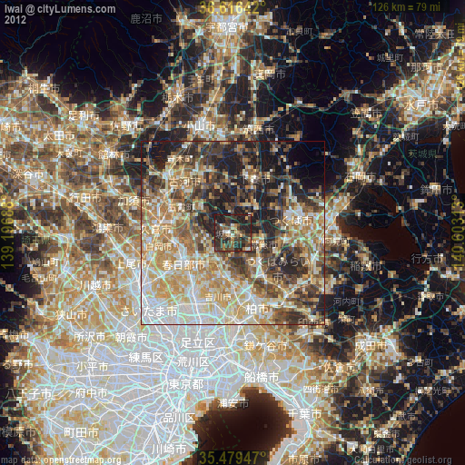
Iwai night lights from space
Night Light of Iwai (Ibaraki) from space (Japan) Src. Average luminocity for 10x10km area is 32.6245% and for 50x50km: 50.767%.
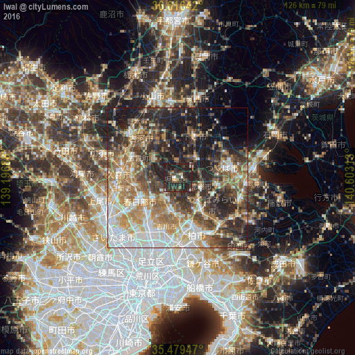
Analysis of Iwai night lights 2016
Square area 10x10 km:
100  1.65%
1.65%
90-99 3.3%
80-89 1.28%
70-79 2.93%
60-69 1.47%
50-59 2.01%
40-49 10.26%
30-39 17.95%
20-29 31.14%
10-19 28.02%
0-9 0%
1.65%90-99
3.3%80-89
1.28%70-79
2.93%60-69
1.47%50-59
2.01%40-49
10.26%30-39
17.95%20-29
31.14%10-19
28.02%0-9
0%Square area 50x50 km:
100 8.64%
90-99 10.24%
80-89 5.3%
70-79 6.77%
60-69 9.34%
50-59 8.28%
40-49 7.69%
30-39 9.66%
20-29 13.27%
10-19 14.74%
0-9 6.08%
8.64%90-99
10.24%80-89
5.3%70-79
6.77%60-69
9.34%50-59
8.28%40-49
7.69%30-39
9.66%20-29
13.27%10-19
14.74%0-9
6.08%Clear (daylight) street map image can be seen on geolist.org.
Map coordinates:
36° 36' 59.1" North, 139° 11' 48.8" East
36° 3' 0" North, 139° 54' 0" East
35° 28' 46.1" North, 140° 36' 11.3" East
Some cities around Iwai sort by population:
• Kasukabe
15.4 km =9.6 mi,  241°
241°
• Noda
11.6 km =7.2 mi,  194°
194°
• Moriya
15.8 km =9.8 mi,  145°
145°
• Satte
15.8 km =9.8 mi,  279°
279°
• Sugito
15.8 km =9.8 mi,  262°
262°
• Mitsukaidō
8.4 km =5.2 mi,  116°
116°
• Sakai
10.6 km =6.6 mi,  301°
301°
• Ishige
9.5 km =5.9 mi,  38°
38°
1861223 (p: 42,497)
Sources (retrieved 2019-11-25):
» Earth at Night: Flat Maps 2012, 2016