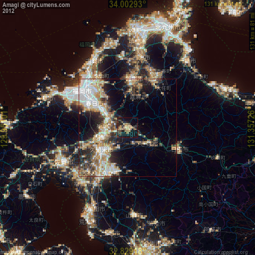
Amagi night lights from space
Night Light of Amagi (Fukuoka) from space (Japan) Src. Average luminocity for 10x10km area is 23.2115% and for 50x50km: 23.9472%.
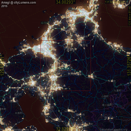
Analysis of Amagi night lights 2016
Square area 10x10 km:
 0%
0%90-99
1.05%80-89
4.2%70-79
2.8%60-69
5.77%50-59
1.92%40-49
7.52%30-39
4.9%20-29
6.29%10-19
26.57%0-9
38.99%Square area 50x50 km:
3.8%90-99
4.1%80-89
2.9%70-79
2.83%60-69
3.85%50-59
3.97%40-49
3.07%30-39
4.42%20-29
7.05%10-19
10.98%0-9
53.04%Clear (daylight) street map image can be seen on geolist.org.
Map coordinates:
34° 0' 10.5" North, 129° 57' 3.6" East
33° 25' 4.9" North, 130° 39' 14.9" East
32° 49' 45" North, 131° 21' 26.1" East
Some cities around Amagi sort by population:
• Kurume
17 km =10.6 mi,  228°
228°
• Chikushino-shi
15.5 km =9.6 mi,  304°
304°
• Ōnojō
20.9 km =13 mi,  308°
308°
• Dazaifu
16 km =9.9 mi, 311°
• Tosu
14 km =8.7 mi,  245°
245°
• Umi
21.4 km =13.3 mi,  321°
321°
• Sasaguri
24 km =14.9 mi,  336°
336°
• Tanushimarumachi-toyoki
8 km =5 mi,  160°
160°
1865375 (p: 42,312)
Sources (retrieved 2019-11-25):
» Earth at Night: Flat Maps 2012, 2016