Sasaguri night lights from space
Night Light of Sasaguri (Fukuoka) from space (Japan) Src. Average luminocity for 10x10km area is 24.2326% and for 50x50km: 29.6655%.
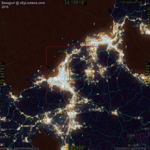
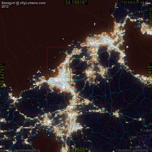
Analysis of Sasaguri night lights 2016
Square area 10x10 km:
100  0.37%
0.37%
90-99 1.83%
80-89 2.2%
70-79 2.2%
60-69 8.06%
50-59 6.96%
40-49 4.21%
30-39 3.48%
20-29 11.17%
10-19 17.58%
0-9 41.94%
0.37%90-99
1.83%80-89
2.2%70-79
2.2%60-69
8.06%50-59
6.96%40-49
4.21%30-39
3.48%20-29
11.17%10-19
17.58%0-9
41.94%Square area 50x50 km:
100 4.99%
90-99 5.05%
80-89 3.13%
70-79 3.39%
60-69 4.39%
50-59 5.54%
40-49 3.37%
30-39 5.26%
20-29 9.81%
10-19 16.15%
0-9 38.95%
4.99%90-99
5.05%80-89
3.13%70-79
3.39%60-69
4.39%50-59
5.54%40-49
3.37%30-39
5.26%20-29
9.81%10-19
16.15%0-9
38.95%Clear (daylight) street map image can be seen on geolist.org.
Map coordinates:
34° 11' 57" North, 129° 50' 52.5" East
33° 36' 56.2" North, 130° 33' 3.8" East
33° 1' 41.1" North, 131° 15' 15" East
Some cities around Sasaguri sort by population:
• Fukuoka
12.6 km =7.8 mi,  262°
262°
• Chikushino-shi
13.7 km =8.5 mi,  193°
193°
• Ōnojō
11.1 km =6.9 mi,  217°
217°
• Iizuka
12.8 km =8 mi,  79°
79°
• Dazaifu
11.7 km =7.3 mi, 192°
• Koga
15.2 km =9.4 mi,  329°
329°
• Umi
6.5 km =4 mi, 215°
• Miyata
14 km =8.7 mi,  42°
42°
1852915 (p: 32,588)
Sources (retrieved 2019-11-25):
» Earth at Night: Flat Maps 2012, 2016