Kurume night lights from space
Night Light of Kurume (Fukuoka) from space (Japan) Src. Average luminocity for 10x10km area is 63.4003% and for 50x50km: 22.139%.
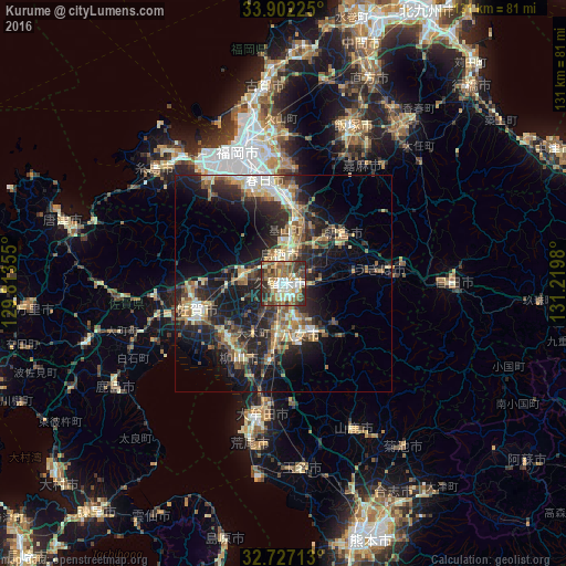
Analysis of Kurume night lights 2016
Square area 10x10 km:
 8.74%
8.74%90-99
14.34%80-89
8.04%70-79
7.69%60-69
13.46%50-59
12.76%40-49
10.84%30-39
15.91%20-29
8.22%10-19
0%0-9
0%Square area 50x50 km:
1.7%90-99
3.28%80-89
2.91%70-79
2.6%60-69
3.7%50-59
4.27%40-49
3.08%30-39
4.66%20-29
9.18%10-19
15.06%0-9
49.56%Clear (daylight) street map image can be seen on geolist.org.
Map coordinates:
33° 54' 8.1" North, 129° 48' 48.8" East
33° 19' 0" North, 130° 31' 0" East
32° 43' 37.7" North, 131° 13' 11.3" East
Some cities around Kurume sort by population:
• Chikushino-shi
20 km =12.4 mi,  359°
359°
• Tosu
5.6 km =3.5 mi,  0°
0°
• Amagi
17 km =10.6 mi,  48°
48°
• Yanagawa
19.9 km =12.4 mi,  213°
213°
• Ōkawa
18 km =11.2 mi,  226°
226°
• Setakamachi-takayanagi
19.3 km =12 mi,  194°
194°
• Tanushimarumachi-toyoki
15.9 km =9.9 mi,  76°
76°
• Kanzakimachi-kanzaki
13.3 km =8.3 mi,  266°
266°
1858088 (p: 238,197)
Sources (retrieved 2019-11-25):
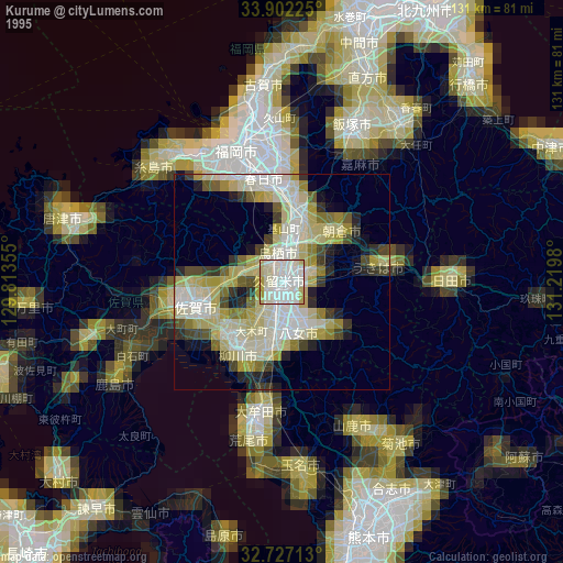
» NASA, Earths city lights 1995
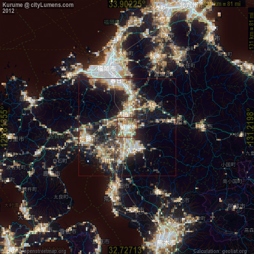
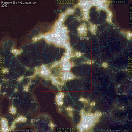
» NASA city lights 2003
» Earth at Night: Flat Maps 2012, 2016