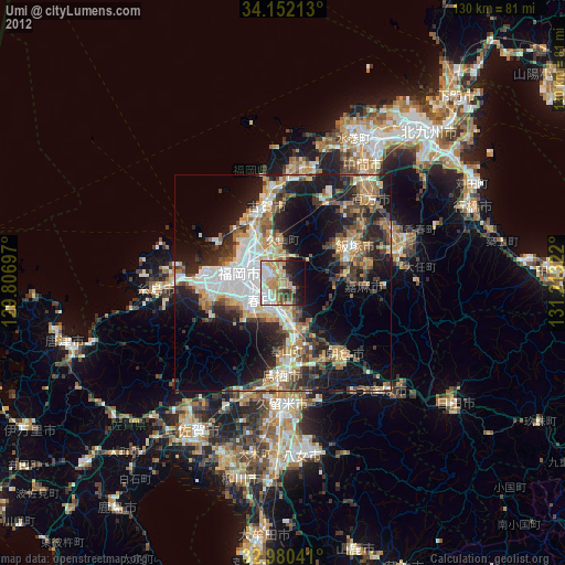
Umi night lights from space
Night Light of Umi (Fukuoka) from space (Japan) Src. Average luminocity for 10x10km area is 59.1593% and for 50x50km: 29.0584%.
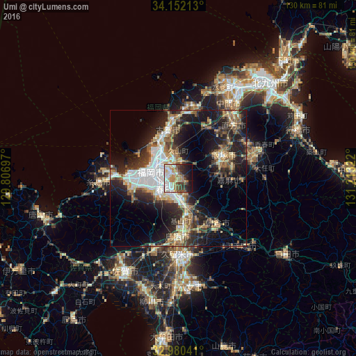
Analysis of Umi night lights 2016
Square area 10x10 km:
100  12.64%
90-99 13.55%
80-89 7.51%
70-79 6.59%
60-69 13%
50-59 7.69%
40-49 5.49%
30-39 7.33%
20-29 10.62%
10-19 14.47%
0-9 1.1%
12.64%90-99
13.55%80-89
7.51%70-79
6.59%60-69
13%50-59
7.69%40-49
5.49%30-39
7.33%20-29
10.62%10-19
14.47%0-9
1.1%Square area 50x50 km:
100 5.05%
90-99 5.1%
80-89 3.22%
70-79 3.28%
60-69 3.96%
50-59 4.9%
40-49 3.35%
30-39 5%
20-29 9.94%
10-19 15.41%
0-9 40.8%
5.05%90-99
5.1%80-89
3.22%70-79
3.28%60-69
3.96%50-59
4.9%40-49
3.35%30-39
5%20-29
9.94%10-19
15.41%0-9
40.8%Clear (daylight) street map image can be seen on geolist.org.
Map coordinates:
34° 9' 7.7" North, 129° 48' 25.1" East
33° 34' 5.7" North, 130° 30' 36.3" East
32° 58' 49.5" North, 131° 12' 47.6" East
Some cities around Umi sort by population:
• Fukuoka
9.3 km =5.8 mi,  292°
292°
• Chikushino-shi
8 km =5 mi,  176°
176°
• Ōnojō
4.7 km =2.9 mi,  218°
218°
• Iizuka
18 km =11.2 mi,  65°
65°
• Dazaifu
6.3 km =3.9 mi,  168°
168°
• Koga
18.8 km =11.7 mi,  347°
347°
• Sasaguri
6.5 km =4 mi,  35°
35°
• Shingū
17.8 km =11.1 mi,  335°
335°
1849299 (p: 39,772)
Sources (retrieved 2019-11-25):
» Earth at Night: Flat Maps 2012, 2016