Kitim night lights from space
Night Light of Kitim (Irbid) from space (Jordan) Src. Average luminocity for 10x10km area is 54.0714% and for 50x50km: 44.5818%.
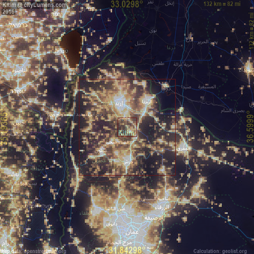
Analysis of Kitim night lights 2016
Square area 10x10 km:
100  1.28%
1.28%
90-99 2.56%
80-89 15.02%
70-79 9.34%
60-69 6.96%
50-59 11.9%
40-49 24.91%
30-39 17.22%
20-29 10.81%
10-19 0%
0-9 0%
1.28%90-99
2.56%80-89
15.02%70-79
9.34%60-69
6.96%50-59
11.9%40-49
24.91%30-39
17.22%20-29
10.81%10-19
0%0-9
0%Square area 50x50 km:
100 3.07%
90-99 4.2%
80-89 9.69%
70-79 8.23%
60-69 6.07%
50-59 7.6%
40-49 11.76%
30-39 10.3%
20-29 15.52%
10-19 16.5%
0-9 7.08%
3.07%90-99
4.2%80-89
9.69%70-79
8.23%60-69
6.07%50-59
7.6%40-49
11.76%30-39
10.3%20-29
15.52%10-19
16.5%0-9
7.08%Clear (daylight) street map image can be seen on geolist.org.
Map coordinates:
33° 1' 47.3" North, 35° 11' 37.1" East
32° 26' 18" North, 35° 53' 48.4" East
31° 50' 34.7" North, 36° 35' 59.6" East
Some cities around Kitim sort by population:
• Irbid
13.8 km =8.6 mi,  341°
341°
• Aydūn
8.3 km =5.2 mi,  334°
334°
• Sūf
14.9 km =9.3 mi,  202°
202°
• Şakhrah
9.1 km =5.7 mi,  214°
214°
• Bayt Yāfā
14 km =8.7 mi,  312°
312°
• Sāl
14.6 km =9.1 mi,  5°
5°
• Dayr Yūsuf
10.9 km =6.8 mi,  299°
299°
• Balīlā
6.5 km =4 mi,  143°
143°
248434 (p: 5,292)
Sources (retrieved 2019-11-25):
» Earth at Night: Flat Maps 2012, 2016