Şakhrah night lights from space
Night Light of Şakhrah (Ajlun) from space (Jordan) Src. Average luminocity for 10x10km area is 56.8388% and for 50x50km: 44.0864%.
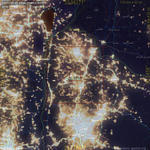
Analysis of Şakhrah night lights 2016
Square area 10x10 km:
100  3.66%
3.66%
90-99 5.49%
80-89 8.42%
70-79 8.42%
60-69 13.92%
50-59 14.65%
40-49 24.91%
30-39 15.02%
20-29 5.49%
10-19 0%
0-9 0%
3.66%90-99
5.49%80-89
8.42%70-79
8.42%60-69
13.92%50-59
14.65%40-49
24.91%30-39
15.02%20-29
5.49%10-19
0%0-9
0%Square area 50x50 km:
100 2.99%
90-99 4.07%
80-89 9.3%
70-79 7.89%
60-69 6.12%
50-59 7.31%
40-49 11.87%
30-39 10.24%
20-29 14.43%
10-19 21.25%
0-9 4.53%
2.99%90-99
4.07%80-89
9.3%70-79
7.89%60-69
6.12%50-59
7.31%40-49
11.87%30-39
10.24%20-29
14.43%10-19
21.25%0-9
4.53%Clear (daylight) street map image can be seen on geolist.org.
Map coordinates:
32° 57' 46" North, 35° 8' 22.4" East
32° 22' 15.1" North, 35° 50' 33.6" East
31° 46' 30.3" North, 36° 32' 44.9" East
Some cities around Şakhrah sort by population:
• ‘Ajlūn
9.4 km =5.8 mi,  243°
243°
• Sūf
6.4 km =4 mi,  184°
184°
• Sakib
10.1 km =6.3 mi,  198°
198°
• ‘Ayn Jannah
8.4 km =5.2 mi, 241°
• Raymūn
10 km =6.2 mi,  188°
188°
• Al Kittah
10.5 km =6.5 mi, 180°
• Kitim
9.1 km =5.7 mi,  34°
34°
• Balīlā
9.3 km =5.8 mi,  75°
75°
247074 (p: 10,616)
Sources (retrieved 2019-11-25):
» Earth at Night: Flat Maps 2012, 2016